The American Atlas
Bildnummer 11674317
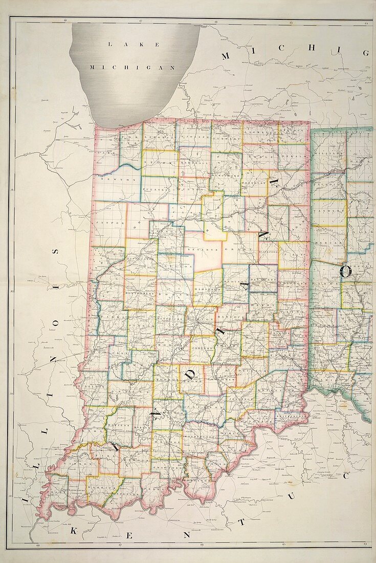
| Indiana,Map of Indiana. Image taken from The American Atlas; exhibiting the Post Offices,Post Roads,Rail Roads,Canals,and the Physical and Political Divisions of the United States of North America; Constructed from the Government Surveys and other Official Materials. By D.H. Burr. John Arrowsmith del. Originally published in Washington,D.C. : D.H. Burr,July 10th,1839. Author D H Burr,Illustrated by John Arrowsmith | |
| Lizenzart: | Lizenzpflichtig |
| Credit: | Science Photo Library / British Library |
| Bildgröße: | 3417 px × 5115 px |
| Modell-Rechte: | nicht erforderlich |
| Eigentums-Rechte: | nicht erforderlich |
| Restrictions: | - |
Preise für dieses Bild ab 15 €
Universitäten & Organisationen
(Informationsmaterial Digital, Informationsmaterial Print, Lehrmaterial Digital etc.)
ab 15 €
Redaktionell
(Bücher, Bücher: Sach- und Fachliteratur, Digitale Medien (redaktionell) etc.)
ab 30 €
Werbung
(Anzeigen, Aussenwerbung, Digitale Medien, Fernsehwerbung, Karten, Werbemittel, Zeitschriften etc.)
ab 55 €
Handelsprodukte
(bedruckte Textilie, Kalender, Postkarte, Grußkarte, Verpackung etc.)
ab 75 €
Pauschalpreise
Rechtepakete für die unbeschränkte Bildnutzung in Print oder Online
ab 495 €