The Fort at Tienderoga
Bildnummer 11673752
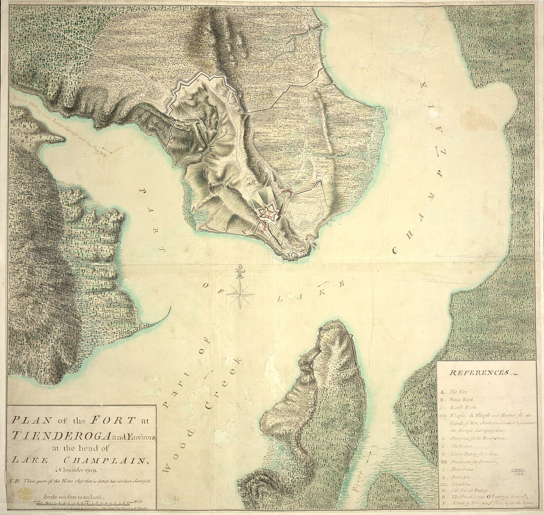
| Plan of the Fort at Tienderoga and Environs at the Head of Lake Champlain,November 1759. Image taken from Plan of the Fort at Tienderoga sic and Environs at the Head of Lake Champlain,November 1759. N.B. Those parts of the Water edge that is dotted has not been Survey'd. The Fort and Lines survey'd by Lieut Brheam sic,i.e. William Gerard de Brahm,Assist Enginr,the Ground by Wm Brasier. Wm Brasier Delt. References: A-P. Scale,400 Feet to an Inch. Originally published in November,1759 | |
| Lizenzart: | Lizenzpflichtig |
| Credit: | Science Photo Library / British Library |
| Bildgröße: | 4298 px × 4066 px |
| Modell-Rechte: | nicht erforderlich |
| Eigentums-Rechte: | nicht erforderlich |
| Restrictions: | - |
Preise für dieses Bild ab 15 €
Universitäten & Organisationen
(Informationsmaterial Digital, Informationsmaterial Print, Lehrmaterial Digital etc.)
ab 15 €
Redaktionell
(Bücher, Bücher: Sach- und Fachliteratur, Digitale Medien (redaktionell) etc.)
ab 30 €
Werbung
(Anzeigen, Aussenwerbung, Digitale Medien, Fernsehwerbung, Karten, Werbemittel, Zeitschriften etc.)
ab 55 €
Handelsprodukte
(bedruckte Textilie, Kalender, Postkarte, Grußkarte, Verpackung etc.)
ab 75 €
Pauschalpreise
Rechtepakete für die unbeschränkte Bildnutzung in Print oder Online
ab 495 €