Map of Europe and Asia Minor
Bildnummer 11673355
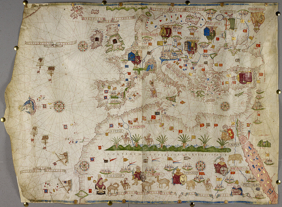
| Map of Europe Asia Minor and Africa,as far south as Cape Rosso; with the Azores,Madeira,Canary Islands,Cape Verde Islands.The Mediterranean Sea,Black Sea,Red Sea,and coast of Arabia. The map is ornamented with drawings of rulers,including the Kings of France,Poland,Hungary,and the Grand Sultan; and exotic animals,including camels and elephants Image taken from . Originally published in Italy; second half of 15th century | |
| Lizenzart: | Lizenzpflichtig |
| Credit: | Science Photo Library / British Library |
| Bildgröße: | 4879 px × 3582 px |
| Modell-Rechte: | nicht erforderlich |
| Eigentums-Rechte: | nicht erforderlich |
| Restrictions: | - |
Preise für dieses Bild ab 15 €
Universitäten & Organisationen
(Informationsmaterial Digital, Informationsmaterial Print, Lehrmaterial Digital etc.)
ab 15 €
Redaktionell
(Bücher, Bücher: Sach- und Fachliteratur, Digitale Medien (redaktionell) etc.)
ab 30 €
Werbung
(Anzeigen, Aussenwerbung, Digitale Medien, Fernsehwerbung, Karten, Werbemittel, Zeitschriften etc.)
ab 55 €
Handelsprodukte
(bedruckte Textilie, Kalender, Postkarte, Grußkarte, Verpackung etc.)
ab 75 €
Pauschalpreise
Rechtepakete für die unbeschränkte Bildnutzung in Print oder Online
ab 495 €