First geological map of Britain,1815
Bildnummer 11653984
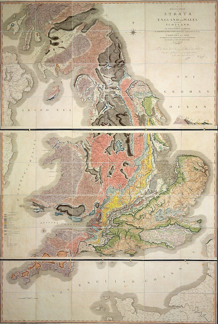
| First geological map of Britain. This map was published in 1815 by British geologist William Smith (1769-1839). It shows rock layers (strata) in England and Wales and part of Scotland (key at lower left). Smith's work as a canal surveyor allowed him to study geology. He discovered that geological strata could be reliably identified at different places on the basis of the fossils they contained. Smith also proposed the principle of superposition,that if a strata overlays another then it was laid down at a later time. He is considered the father of English geology. This map,published in London,is dedicated (upper right) to British naturalist Sir Joseph Banks (1743-1820) | |
| Lizenzart: | Lizenzpflichtig |
| Credit: | Science Photo Library / British Library |
| Bildgröße: | 3604 px × 5350 px |
| Modell-Rechte: | nicht erforderlich |
| Eigentums-Rechte: | nicht erforderlich |
| Restrictions: | - |
Preise für dieses Bild ab 15 €
Universitäten & Organisationen
(Informationsmaterial Digital, Informationsmaterial Print, Lehrmaterial Digital etc.)
ab 15 €
Redaktionell
(Bücher, Bücher: Sach- und Fachliteratur, Digitale Medien (redaktionell) etc.)
ab 30 €
Werbung
(Anzeigen, Aussenwerbung, Digitale Medien, Fernsehwerbung, Karten, Werbemittel, Zeitschriften etc.)
ab 55 €
Handelsprodukte
(bedruckte Textilie, Kalender, Postkarte, Grußkarte, Verpackung etc.)
ab 75 €
Pauschalpreise
Rechtepakete für die unbeschränkte Bildnutzung in Print oder Online
ab 495 €
Keywords
- 1800er Jahre,
- 19. Jahrhundert,
- britisch,
- England,
- Englisch,
- Erdkunde,
- erst,
- Europa,
- europäisch,
- früh,
- geografisch,
- Geographie,
- Geologie,
- geologisch,
- Geschichte,
- Großbritannien,
- historisch,
- Illustration,
- Joseph Banks,
- Karte,
- Kartographie,
- Kunstwerk,
- Land,
- Region,
- Schichten,
- schottisch,
- Schottland,
- Vereinigtes Königreich,
- Wales,
- Walisisch,
- wegweisend,
- Widmung,
- William Smith