The Americas,sea floor topography
Bildnummer 11648940
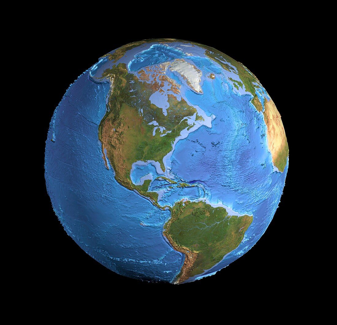
| The Americas,sea floor topography. Computer graphic of an Earth globe centred on the Americas,generated using satellite and mapping data. The land surface is represented with cloud-free satellite images in natural colours. Digital terrain and bathymetric data are used for the land and seabed contours. Ocean depths are colour-coded: light blue on the shallow continental shelves to darker blue for the deep trenches and abyssal plains. Features include the Rockies and Andes mountain ranges,Pacific seamounts and island chains (left),several subduction trenches,and the Mid-Atlantic Ridge (right). At top is the Arctic Ocean and Greenland | |
| Lizenzart: | Lizenzpflichtig |
| Credit: | Science Photo Library / Planetary Visions |
| Bildgröße: | 4317 px × 4163 px |
| Modell-Rechte: | nicht erforderlich |
| Eigentums-Rechte: | nicht erforderlich |
| Restrictions: | - |
Preise für dieses Bild ab 15 €
Universitäten & Organisationen
(Informationsmaterial Digital, Informationsmaterial Print, Lehrmaterial Digital etc.)
ab 15 €
Redaktionell
(Bücher, Bücher: Sach- und Fachliteratur, Digitale Medien (redaktionell) etc.)
ab 30 €
Werbung
(Anzeigen, Aussenwerbung, Digitale Medien, Fernsehwerbung, Karten, Werbemittel, Zeitschriften etc.)
ab 55 €
Handelsprodukte
(bedruckte Textilie, Kalender, Postkarte, Grußkarte, Verpackung etc.)
ab 75 €
Pauschalpreise
Rechtepakete für die unbeschränkte Bildnutzung in Print oder Online
ab 495 €
Keywords
- Anden,
- Arktis,
- Atlantischer Ozean,
- ausgeschnitten,
- Ausschnitte,
- Ball,
- Bathymetrie,
- bathymetrisch,
- Berge,
- Bergkette,
- Erdbeobachtung,
- Erde,
- Erdkunde,
- geografisch,
- Geographie,
- Geologie,
- geologisch,
- Globus,
- Grenze,
- Karibik,
- Kontinent,
- Kontinente,
- Kugel,
- kugelförmig,
- Land,
- Marine,
- Meer,
- Meeresboden,
- Meereskunde,
- Nordamerika,
- nordamerikanisch,
- Ozean,
- Pazifik,
- Planet,
- planetarisch,
- Rockies,
- Rocky Mountains,
- Satellit,
- Satellitenbild,
- schwarzer Hintergrund,
- Seismologie,
- Südamerika,
- Südamerikanisch,
- tektonischen Platten,
- Tiefe,
- topografisch,
- Topographie,
- Unterwasser,
- Weltall,
- wolkenfrei,
- Zentralamerika