Earth,satellite image
Bildnummer 11648326
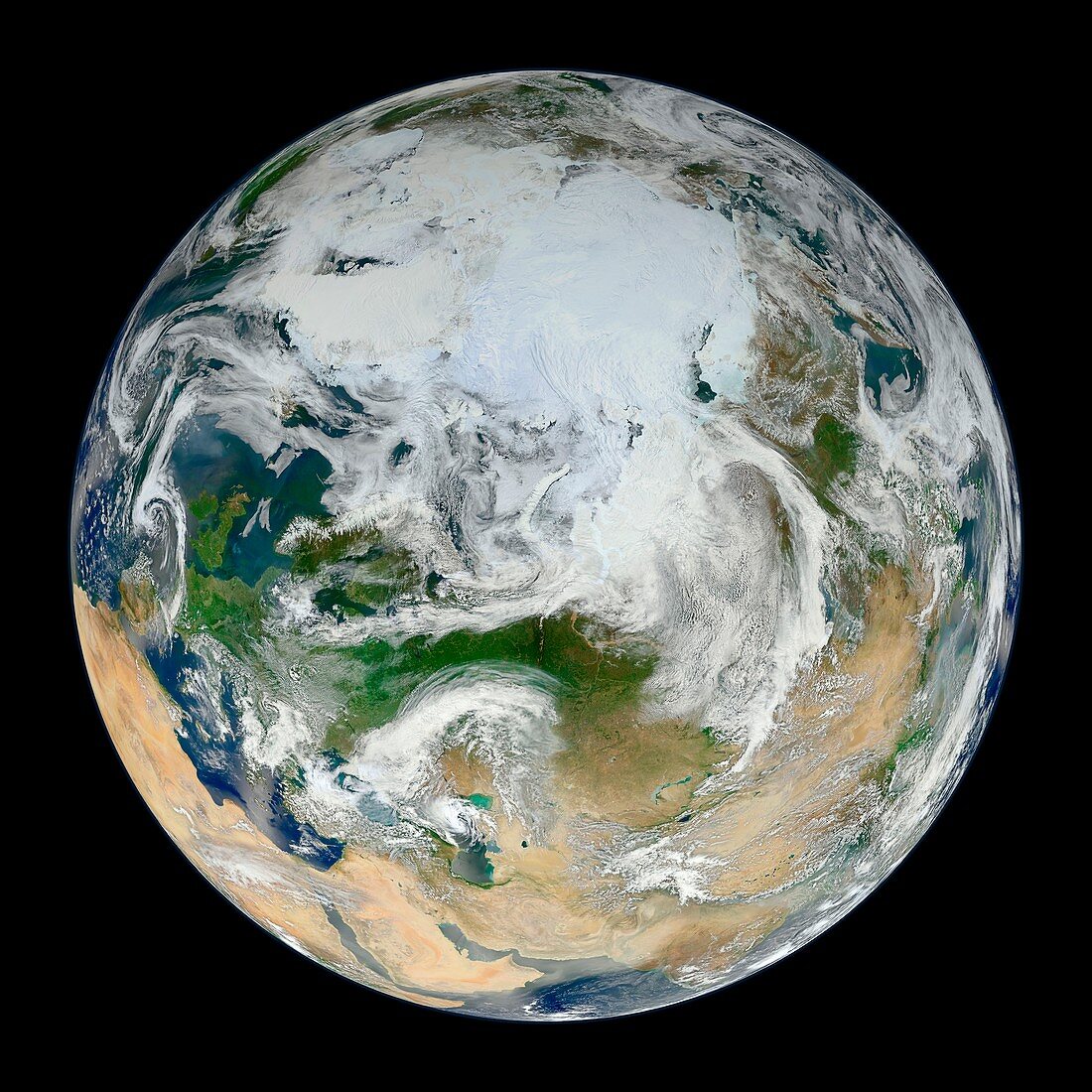
| Earth. 'Blue Marble' satellite image of the Earth,showing the North Pole (white,upper centre),Europe (centre left) and Asia (centre right). This is a composite image combined from data collected on 4th January 2012 and 26th May 2012. The data used to make this image was recorded in 22 spectral bands covering visible,near-infrared,and thermal infrared regions of the electromagnetic spectrum. Imaged by the VIIRS (Visible Infrared Imaging Radiometer Suite) instrument on NASA's Suomi NPP (National Polar-orbiting Partnership) satellite | |
| Lizenzart: | Lizenzpflichtig |
| Credit: | Science Photo Library / NASA |
| Bildgröße: | 4594 px × 4594 px |
| Modell-Rechte: | nicht erforderlich |
| Eigentums-Rechte: | nicht erforderlich |
| Restrictions: | - |
Preise für dieses Bild ab 15 €
Universitäten & Organisationen
(Informationsmaterial Digital, Informationsmaterial Print, Lehrmaterial Digital etc.)
ab 15 €
Redaktionell
(Bücher, Bücher: Sach- und Fachliteratur, Digitale Medien (redaktionell) etc.)
ab 30 €
Werbung
(Anzeigen, Aussenwerbung, Digitale Medien, Fernsehwerbung, Karten, Werbemittel, Zeitschriften etc.)
ab 55 €
Handelsprodukte
(bedruckte Textilie, Kalender, Postkarte, Grußkarte, Verpackung etc.)
ab 75 €
Pauschalpreise
Rechtepakete für die unbeschränkte Bildnutzung in Print oder Online
ab 495 €
Keywords
- 1,
- 2012,
- 21. Jahrhundert,
- Arktis,
- Asien,
- ausgeschnitten,
- Ausschnitte,
- Eis,
- Erdbeobachtung,
- Erde,
- Erdkunde,
- Eurasien,
- Europa,
- geografisch,
- Geographie,
- Globus,
- Kreis,
- kreisförmig,
- Krümmung,
- Kurve,
- Land,
- Meer,
- NASA,
- Nordpol,
- Oberfläche,
- Ozean,
- Ozeane,
- Planet,
- Planetenwissenschaft,
- polar,
- Raum,
- rund,
- Satellit,
- Satellitenbild,
- schwarzer Hintergrund,
- Sonnensystem,
- Suomi NPP,
- viirs,
- Welt,
- Weltall,
- weltweit,
- Wolken,
- Wolkendecke