British Isles,satellite artwork
Bildnummer 11646462
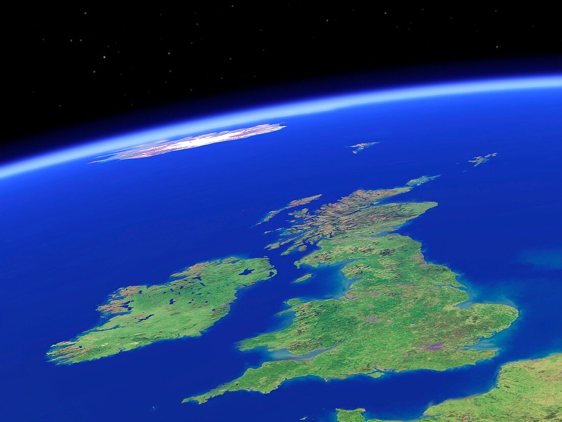
| British Isles. Simulated satellite image of the British Isles taken from low Earth orbit,created using a cloud-free mosaic of satellite images. Beyond the UK and Ireland lies the northeast Atlantic Ocean,with the Faroe Islands and Iceland visible on the horizon. In the background,stars are shown in their correct position,colour and relative brightness,using data from a star catalogue | |
| Lizenzart: | Lizenzpflichtig |
| Credit: | Science Photo Library / Planetary Visions |
| Bildgröße: | 4063 px × 3047 px |
| Modell-Rechte: | nicht erforderlich |
| Restrictions: | - |
Preise für dieses Bild ab 15 €
Universitäten & Organisationen
(Informationsmaterial Digital, Informationsmaterial Print, Lehrmaterial Digital etc.)
ab 15 €
Redaktionell
(Bücher, Bücher: Sach- und Fachliteratur, Digitale Medien (redaktionell) etc.)
ab 30 €
Werbung
(Anzeigen, Aussenwerbung, Digitale Medien, Fernsehwerbung, Karten, Werbemittel, Zeitschriften etc.)
ab 55 €
Handelsprodukte
(bedruckte Textilie, Kalender, Postkarte, Grußkarte, Verpackung etc.)
ab 75 €
Pauschalpreise
Rechtepakete für die unbeschränkte Bildnutzung in Print oder Online
ab 495 €
Keywords
- Atlantischer Ozean,
- Britische Inseln,
- England,
- Europa,
- europäisch,
- geografisch,
- Geographie,
- Großbritannien,
- Insel,
- Inseln,
- Irland,
- Island,
- Krümmung,
- Kunstwerk,
- Küste,
- Küsten-,
- Modell-,
- Mosaik-,
- Nordirland,
- Nordsee,
- Raum,
- Satellitenbild,
- Schottland,
- Simulation,
- simuliert,
- Stern,
- Sterne,
- Umwelt,
- Vereinigtes Königreich,
- Wales,
- Weltall,
- wolkenfrei,
- wolkenlos