US South West,satellite artwork
Bildnummer 11646460
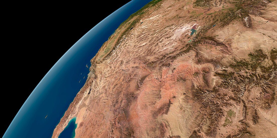
| US South West. Simulated panoramic satellite image of the southwestern United States taken from low Earth orbit. Image created using a cloud-free mosaic of satellite images of the Earth's surface. Major physical features visible on the ground include the Rocky Mountains,the Great Salt Lake,the Great Basin and the Grand Canyon. Beyond,the dry states of Arizona,Nevada and Utah lie the green mountains of the Sierra Nevada and California's Central Valley | |
| Lizenzart: | Lizenzpflichtig |
| Credit: | Science Photo Library / Planetary Visions |
| Bildgröße: | 6502 px × 3246 px |
| Modell-Rechte: | nicht erforderlich |
| Restrictions: | - |
Preise für dieses Bild ab 15 €
Universitäten & Organisationen
(Informationsmaterial Digital, Informationsmaterial Print, Lehrmaterial Digital etc.)
ab 15 €
Redaktionell
(Bücher, Bücher: Sach- und Fachliteratur, Digitale Medien (redaktionell) etc.)
ab 30 €
Werbung
(Anzeigen, Aussenwerbung, Digitale Medien, Fernsehwerbung, Karten, Werbemittel, Zeitschriften etc.)
ab 55 €
Handelsprodukte
(bedruckte Textilie, Kalender, Postkarte, Grußkarte, Verpackung etc.)
ab 75 €
Pauschalpreise
Rechtepakete für die unbeschränkte Bildnutzung in Print oder Online
ab 495 €
Keywords
- Arizona,
- Erde,
- geografisch,
- Geographie,
- Grand Canyon,
- Kalifornien,
- Krümmung,
- Kunstwerk,
- Küste,
- Küsten-,
- Modell-,
- Mosaik-,
- Nordamerika,
- Panorama,
- Panorama-,
- Rocky Mountains,
- Satellitenbild,
- schwarzer Hintergrund,
- Sierra Nevada,
- Simulation,
- simuliert,
- Staat,
- Südwesten,
- Umwelt,
- uns,
- USA,
- Utah,
- Vereinigte Staaten,
- Weltall,
- wolkenfrei,
- wolkenlos