US Southern States,satellite artwork
Bildnummer 11646458
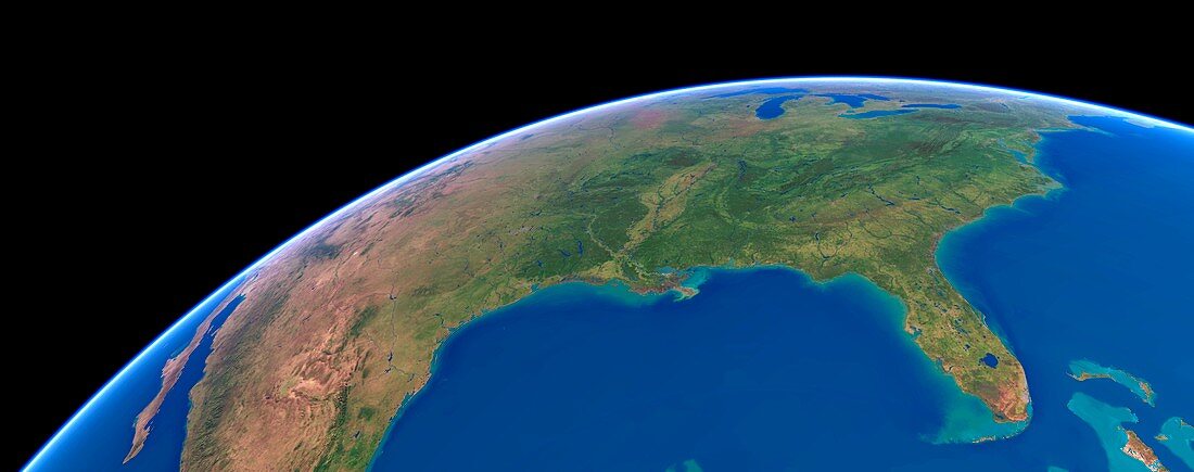
| US Southern States. Simulated panoramic satellite image of the southern United States taken from low Earth orbit over the Gulf of Mexico. This natural-colour cloud-free satellite image-map is made from thousands of images from polar-orbiting weather satellites. Florida and the Mississippi Delta are in the foreground,with the Appalachian Mountains running off to the northeast,and the Great Lakes on the horizon | |
| Lizenzart: | Lizenzpflichtig |
| Credit: | Science Photo Library / Planetary Visions |
| Bildgröße: | 6686 px × 2641 px |
| Modell-Rechte: | nicht erforderlich |
| Restrictions: | - |
Preise für dieses Bild ab 15 €
Universitäten & Organisationen
(Informationsmaterial Digital, Informationsmaterial Print, Lehrmaterial Digital etc.)
ab 15 €
Redaktionell
(Bücher, Bücher: Sach- und Fachliteratur, Digitale Medien (redaktionell) etc.)
ab 30 €
Werbung
(Anzeigen, Aussenwerbung, Digitale Medien, Fernsehwerbung, Karten, Werbemittel, Zeitschriften etc.)
ab 55 €
Handelsprodukte
(bedruckte Textilie, Kalender, Postkarte, Grußkarte, Verpackung etc.)
ab 75 €
Pauschalpreise
Rechtepakete für die unbeschränkte Bildnutzung in Print oder Online
ab 495 €
Keywords
- Atlantischer Ozean,
- Berg,
- bergig,
- Erde,
- Florida,
- gebirgig,
- geografisch,
- Geographie,
- Golf von Mexiko,
- Große Seen,
- Krümmung,
- Kunstwerk,
- Küste,
- Küsten-,
- Modell-,
- Nordamerika,
- Panorama,
- Panorama-,
- Satellitenbild,
- schwarzer Hintergrund,
- Simulation,
- simuliert,
- Staat,
- Umwelt,
- uns,
- USA,
- Vereinigte Staaten,
- Weltall,
- wolkenfrei,
- wolkenlos