Africa,3D artwork
Bildnummer 11646454
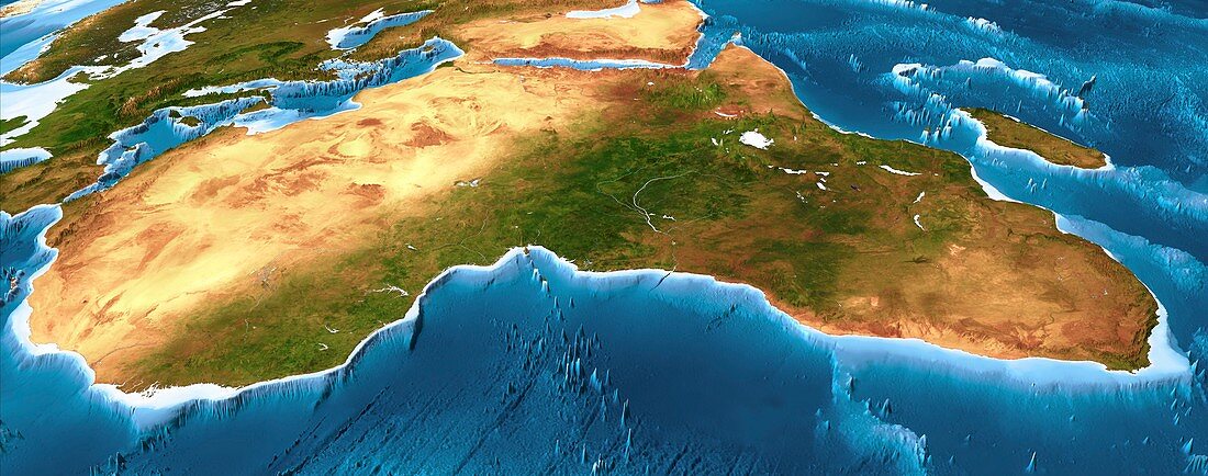
| Africa. 3D computer graphic map of Africa and the surrounding sea floor in the Atlantic and Indian oceans. Image based on cloud-free satellite imagery,digital terrain and bathymetry data. The land is shown in natural colour,based on a cloud-free composite of thousands of weather satellite images,but with height-exaggerated terrain and highlighted rivers and lakes. The sea is shown coloured by depth from white for the shallow continental shelves,to dark blue for the deep ocean trenches | |
| Lizenzart: | Lizenzpflichtig |
| Credit: | Science Photo Library / Planetary Visions |
| Bildgröße: | 6657 px × 2625 px |
| Modell-Rechte: | nicht erforderlich |
| Restrictions: | - |
Preise für dieses Bild ab 15 €
Universitäten & Organisationen
(Informationsmaterial Digital, Informationsmaterial Print, Lehrmaterial Digital etc.)
ab 15 €
Redaktionell
(Bücher, Bücher: Sach- und Fachliteratur, Digitale Medien (redaktionell) etc.)
ab 30 €
Werbung
(Anzeigen, Aussenwerbung, Digitale Medien, Fernsehwerbung, Karten, Werbemittel, Zeitschriften etc.)
ab 55 €
Handelsprodukte
(bedruckte Textilie, Kalender, Postkarte, Grußkarte, Verpackung etc.)
ab 75 €
Pauschalpreise
Rechtepakete für die unbeschränkte Bildnutzung in Print oder Online
ab 495 €
Keywords
- 3-dimensional,
- 3D,
- Afrika,
- Afrikanisch,
- Atlantischer Ozean,
- Bathymetrie,
- bathymetrisch,
- Berg,
- Berge,
- bergig,
- Dreidimensional,
- gebirgig,
- geografisch,
- Geographie,
- Geologie,
- geologisch,
- Gipfel,
- Höhe,
- Karte,
- Kartographie,
- Kunstwerk,
- Küste,
- Küsten-,
- Meer,
- Meeresboden,
- Modell-,
- Panorama,
- Panorama-,
- Regale,
- Satellit,
- Satellitenbild,
- Simulation,
- simuliert,
- Tiefe,
- topografisch,
- Topographie,
- topographisch,
- Umwelt,
- Wasser,
- Weltall,
- wolkenfrei,
- wolkenlos