Hawaiian Islands,3D artwork
Bildnummer 11646449
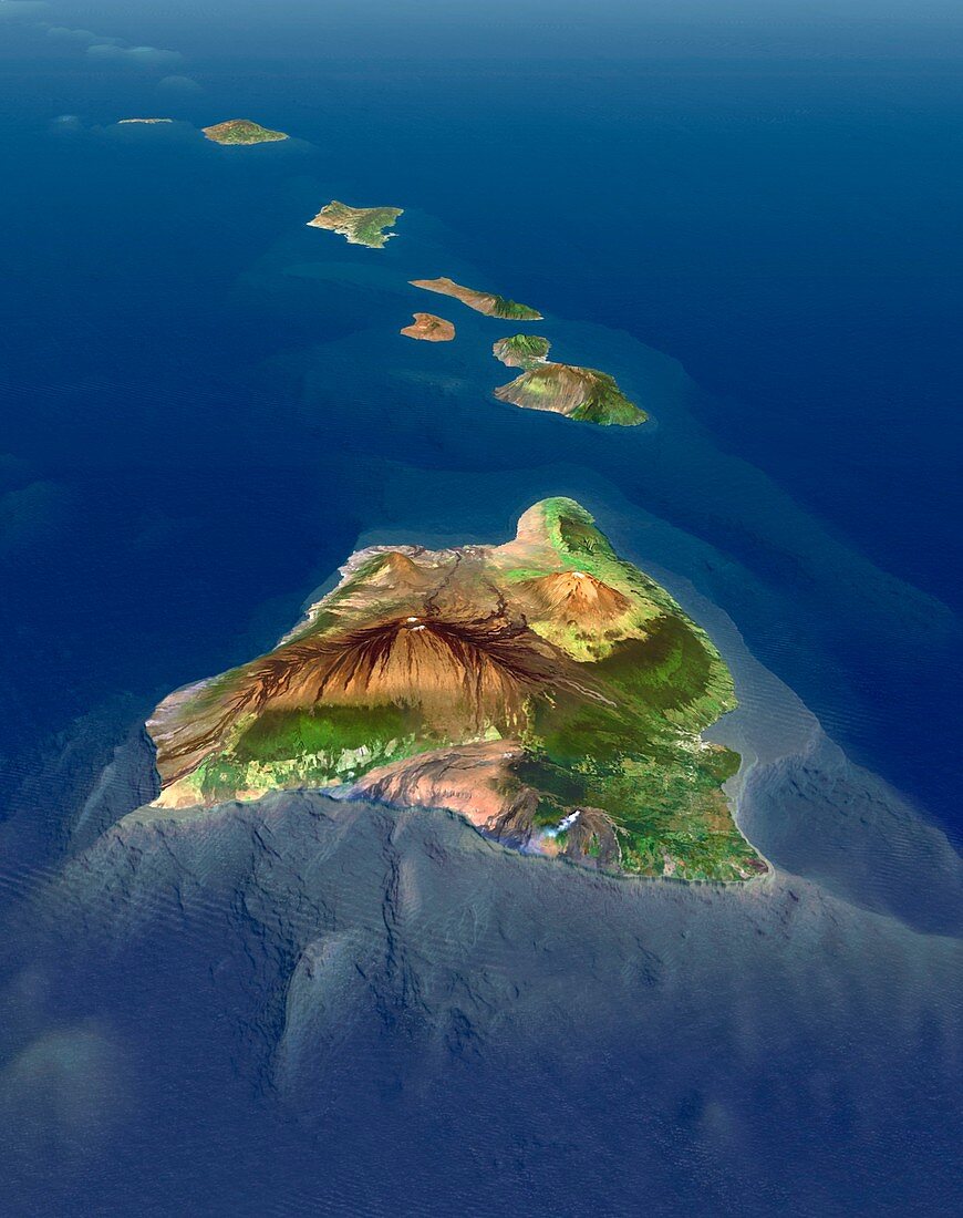
| Hawaiian Islands. Simulated 3D high-altitude view of the Hawaiian Islands,viewed from the east. Image based on Landsat satellite images and detailed digital terrain data. Detailed bathymetry data reveals the topography of the sea floor,showing the Hawaiian Islands to be the tops of immense volcanic mountains rising more than 9,000 metres from the bed of the Pacific Ocean. In the foreground is Hawaii's Big Island,with its volcanoes - Mauna Kea,Mauna Loa,and Kilauea,which is active and smoking in the foreground | |
| Lizenzart: | Lizenzpflichtig |
| Credit: | Science Photo Library / Planetary Visions |
| Bildgröße: | 2641 px × 3341 px |
| Modell-Rechte: | nicht erforderlich |
| Restrictions: | - |
Preise für dieses Bild ab 15 €
Universitäten & Organisationen
(Informationsmaterial Digital, Informationsmaterial Print, Lehrmaterial Digital etc.)
ab 15 €
Redaktionell
(Bücher, Bücher: Sach- und Fachliteratur, Digitale Medien (redaktionell) etc.)
ab 30 €
Werbung
(Anzeigen, Aussenwerbung, Digitale Medien, Fernsehwerbung, Karten, Werbemittel, Zeitschriften etc.)
ab 55 €
Handelsprodukte
(bedruckte Textilie, Kalender, Postkarte, Grußkarte, Verpackung etc.)
ab 75 €
Pauschalpreise
Rechtepakete für die unbeschränkte Bildnutzung in Print oder Online
ab 495 €
Keywords
- 3-dimensional,
- 3D,
- aktiv,
- Amerika,
- Amerikanisch,
- Berg,
- Berge,
- bergig,
- Dreidimensional,
- gebirgig,
- geografisch,
- Geographie,
- Geologie,
- geologisch,
- Gipfel,
- Große Insel,
- Hawaii,
- Insel,
- Inseln,
- Kette,
- Kilauea,
- Kunstwerk,
- Küste,
- Küsten-,
- Landschaft,
- Luftaufnahme,
- Mauna Kea,
- Mauna Loa,
- Modell-,
- Pazifik,
- Satellit,
- Satellitenbild,
- Simulation,
- simuliert,
- Umwelt,
- uns,
- USA,
- Vulkan,
- Vulkane,
- vulkanisch,
- Vulkanologie,
- Wasser,
- Weltall