Alberta,Canada,satellite image
Bildnummer 11639674
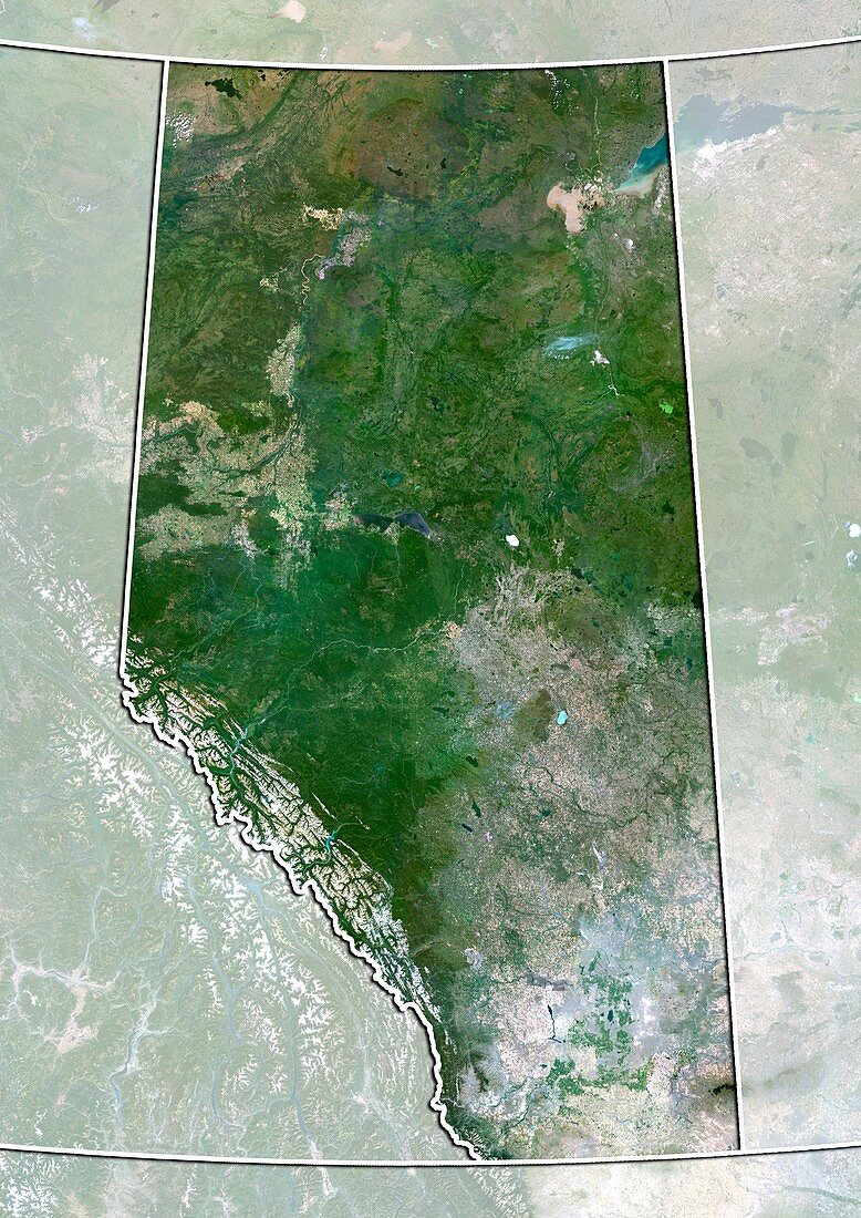
| Alberta,Canada. North is at top. Natural colour satellite image showing the Canadian province of Alberta with the surrounding provinces and territories shaded out. Canada is bordered by the US state of Alaska to the northeast,the mainland USA to the south,and Greenland to the north. Image compiled from data acquired by the LANDSAT 5 and 7 satellites,in 2000. Images highlighting all other regions of this country are available. For further information please contact SPL | |
| Lizenzart: | Lizenzpflichtig |
| Credit: | Science Photo Library / Planetobserver |
| Bildgröße: | 3524 px × 4984 px |
| Modell-Rechte: | nicht erforderlich |
| Restrictions: | - |
Preise für dieses Bild ab 15 €
Universitäten & Organisationen
(Informationsmaterial Digital, Informationsmaterial Print, Lehrmaterial Digital etc.)
ab 15 €
Redaktionell
(Bücher, Bücher: Sach- und Fachliteratur, Digitale Medien (redaktionell) etc.)
ab 30 €
Werbung
(Anzeigen, Aussenwerbung, Digitale Medien, Fernsehwerbung, Karten, Werbemittel, Zeitschriften etc.)
ab 55 €
Handelsprodukte
(bedruckte Textilie, Kalender, Postkarte, Grußkarte, Verpackung etc.)
ab 75 €
Pauschalpreise
Rechtepakete für die unbeschränkte Bildnutzung in Print oder Online
ab 495 €
Keywords
- 2000,
- 21. Jahrhundert,
- Erdbeobachtung,
- geografisch,
- Geographie,
- Grenze,
- Grenzen,
- Kanada,
- Kanadisch,
- Karte,
- Kartographie,
- Land,
- Länder,
- Landsat 7,
- maskiert,
- Nation,
- Natur,
- Natürliche Farbe,
- Nordamerika,
- nordamerikanisch,
- Nördlicher Polarkreis,
- Provinz,
- Rand,
- Satellitenbild,
- Staat,
- topografisch,
- Topographie,
- Umwelt,
- Vogelperspektive,
- Von Oben,
- Weltall