Australia,satellite image
Bildnummer 11639665
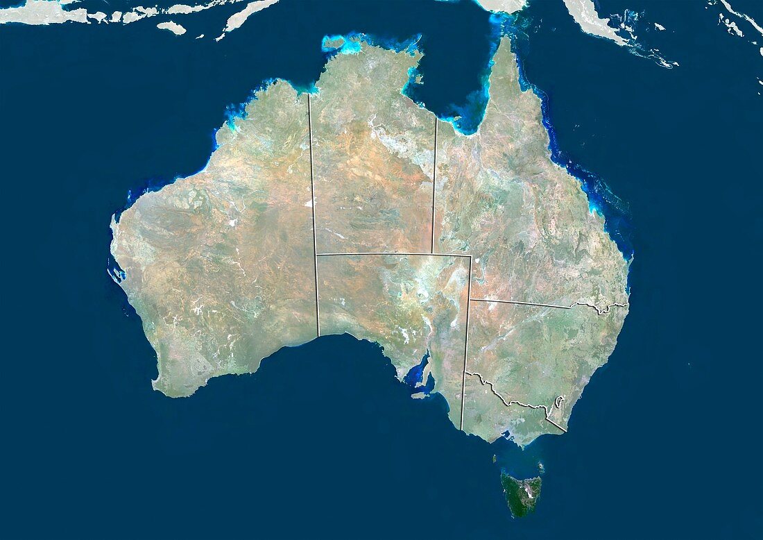
| Australia. Satellite image showing Australia divided into its regions. Australia comprises six states: New South Wales,Queensland,South Australia,Tasmania (island,lower right),Victoria,and Western Australia; and two major mainland territories: the Northern Territory and the Australian Capital Territory. Image compiled from data acquired by the LANDSAT 5 and 7 satellites,in 2000. Images highlighting all other regions of this country are available. For further information please contact SPL | |
| Lizenzart: | Lizenzpflichtig |
| Credit: | Science Photo Library / Planetobserver |
| Bildgröße: | 4978 px × 3523 px |
| Modell-Rechte: | nicht erforderlich |
| Restrictions: | - |
Preise für dieses Bild ab 15 €
Universitäten & Organisationen
(Informationsmaterial Digital, Informationsmaterial Print, Lehrmaterial Digital etc.)
ab 15 €
Redaktionell
(Bücher, Bücher: Sach- und Fachliteratur, Digitale Medien (redaktionell) etc.)
ab 30 €
Werbung
(Anzeigen, Aussenwerbung, Digitale Medien, Fernsehwerbung, Karten, Werbemittel, Zeitschriften etc.)
ab 55 €
Handelsprodukte
(bedruckte Textilie, Kalender, Postkarte, Grußkarte, Verpackung etc.)
ab 75 €
Pauschalpreise
Rechtepakete für die unbeschränkte Bildnutzung in Print oder Online
ab 495 €
Keywords
- 2000,
- 21. Jahrhundert,
- Australien,
- australisch,
- En,
- Erdbeobachtung,
- geografisch,
- Geographie,
- Indischer Ozean,
- Inseln,
- Karte,
- Kartographie,
- Kontinent,
- Land,
- Landsat 7,
- Natur,
- Natürliche Farbe,
- New South Wales,
- Pazifik,
- Queensland,
- Satellit,
- Satellitenbild,
- Staat,
- südlichen Hemisphäre,
- Tasmanien,
- Tasmanisch,
- topografisch,
- Topographie,
- Umwelt,
- Victoria,
- Vogelperspektive,
- Von Oben,
- Weltall,
- Westaustralien,
- wolkenlos