Mainland USA,land cover map
Bildnummer 11638627
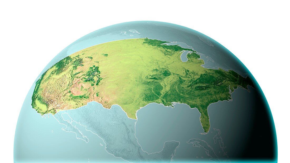
| Mainland USA. Map showing the land cover and terrain of the mainland (contiguous) United States of America (USA). North is at top. This area consists of the 48 states of the USA south of Canada and north of Mexico,and excludes Alaska and Hawaii. The main features of the terrain are the Rocky Mountains in the west,the Appalachian Mountains in the east,and the prairies of the central Great Plains. Dark green areas indicate wetter or forested areas. The land area is just over 8 million square kilometres | |
| Lizenzart: | Lizenzpflichtig |
| Credit: | Science Photo Library / Lunau, Claus |
| Bildgröße: | 5600 px × 3142 px |
| Modell-Rechte: | nicht erforderlich |
| Eigentums-Rechte: | nicht erforderlich |
| Restrictions: | - |
Preise für dieses Bild ab 15 €
Universitäten & Organisationen
(Informationsmaterial Digital, Informationsmaterial Print, Lehrmaterial Digital etc.)
ab 15 €
Redaktionell
(Bücher, Bücher: Sach- und Fachliteratur, Digitale Medien (redaktionell) etc.)
ab 30 €
Werbung
(Anzeigen, Aussenwerbung, Digitale Medien, Fernsehwerbung, Karten, Werbemittel, Zeitschriften etc.)
ab 55 €
Handelsprodukte
(bedruckte Textilie, Kalender, Postkarte, Grußkarte, Verpackung etc.)
ab 75 €
Pauschalpreise
Rechtepakete für die unbeschränkte Bildnutzung in Print oder Online
ab 495 €
Keywords
- Amerikanisch,
- ausgeschnitten,
- Ausschnitte,
- bewaldet,
- Erde,
- geografisch,
- Geographie,
- Great Plains,
- Illustration,
- Kunstwerk,
- Land,
- Nation,
- Natur,
- Nordamerika,
- nordamerikanisch,
- Region,
- Rockies,
- Rocky Mountains,
- sphärische Projektion,
- Terrain,
- uns,
- USA,
- Vegetation,
- Vereinigte Staaten,
- weißer Hintergrund