Gobi Desert,China,satellite image
Bildnummer 11635269
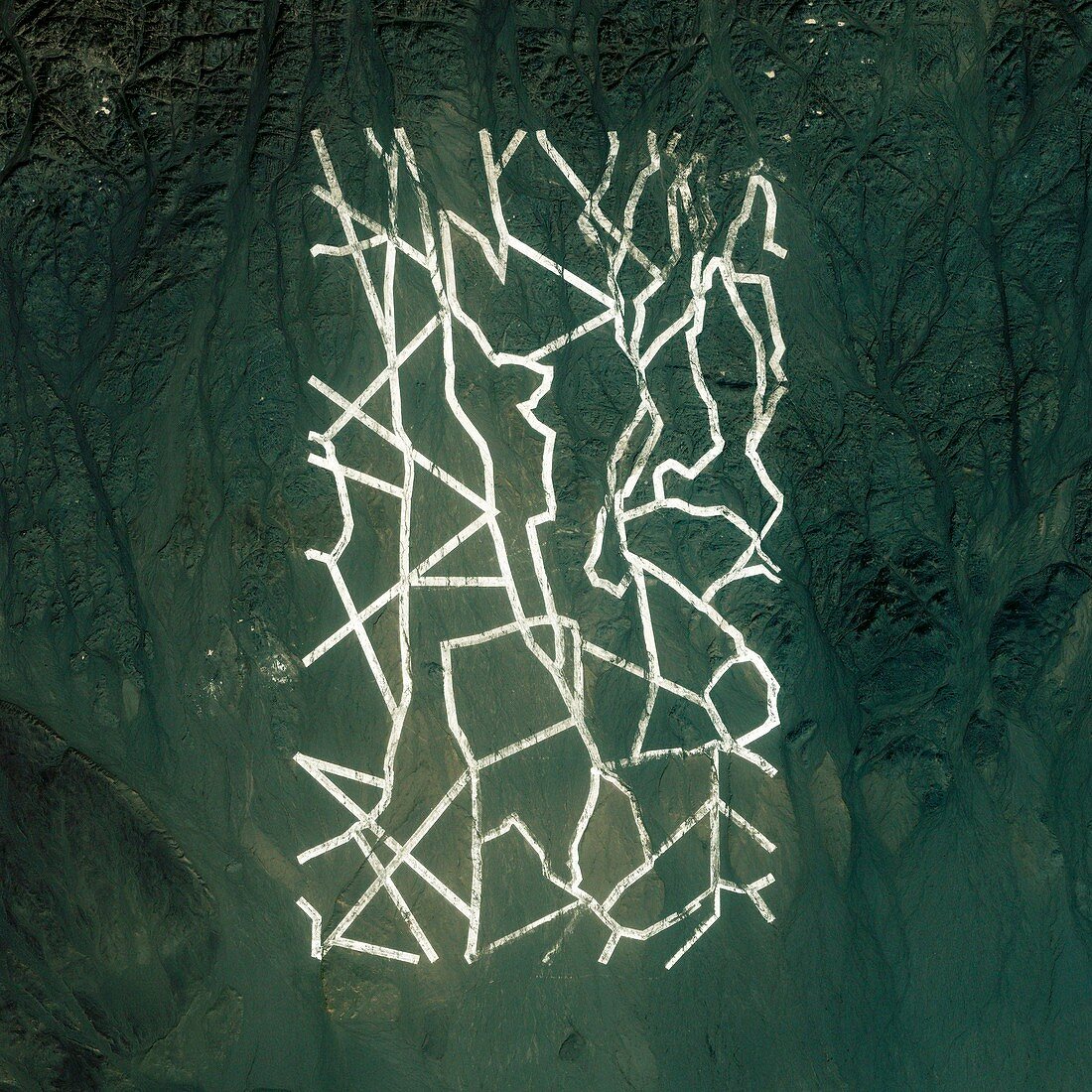
| Gobi Desert. Satellite image showing uniform white lines in the Gobi desert,northwestern China. These lines measure about 1.6 km long and 0.9 km across. Many experts believe they are used as targets for calibrating satellite and radar imaging systems. Imaged by the IKONOS satellite on 27th July 2010 | |
| Lizenzart: | Lizenzpflichtig |
| Credit: | Science Photo Library / Geoeye |
| Bildgröße: | 3000 px × 3000 px |
| Modell-Rechte: | nicht erforderlich |
| Restrictions: | - |
Preise für dieses Bild ab 15 €
Universitäten & Organisationen
(Informationsmaterial Digital, Informationsmaterial Print, Lehrmaterial Digital etc.)
ab 15 €
Redaktionell
(Bücher, Bücher: Sach- und Fachliteratur, Digitale Medien (redaktionell) etc.)
ab 30 €
Werbung
(Anzeigen, Aussenwerbung, Digitale Medien, Fernsehwerbung, Karten, Werbemittel, Zeitschriften etc.)
ab 55 €
Handelsprodukte
(bedruckte Textilie, Kalender, Postkarte, Grußkarte, Verpackung etc.)
ab 75 €
Pauschalpreise
Rechtepakete für die unbeschränkte Bildnutzung in Print oder Online
ab 495 €