China,satellite image
Bildnummer 11633736
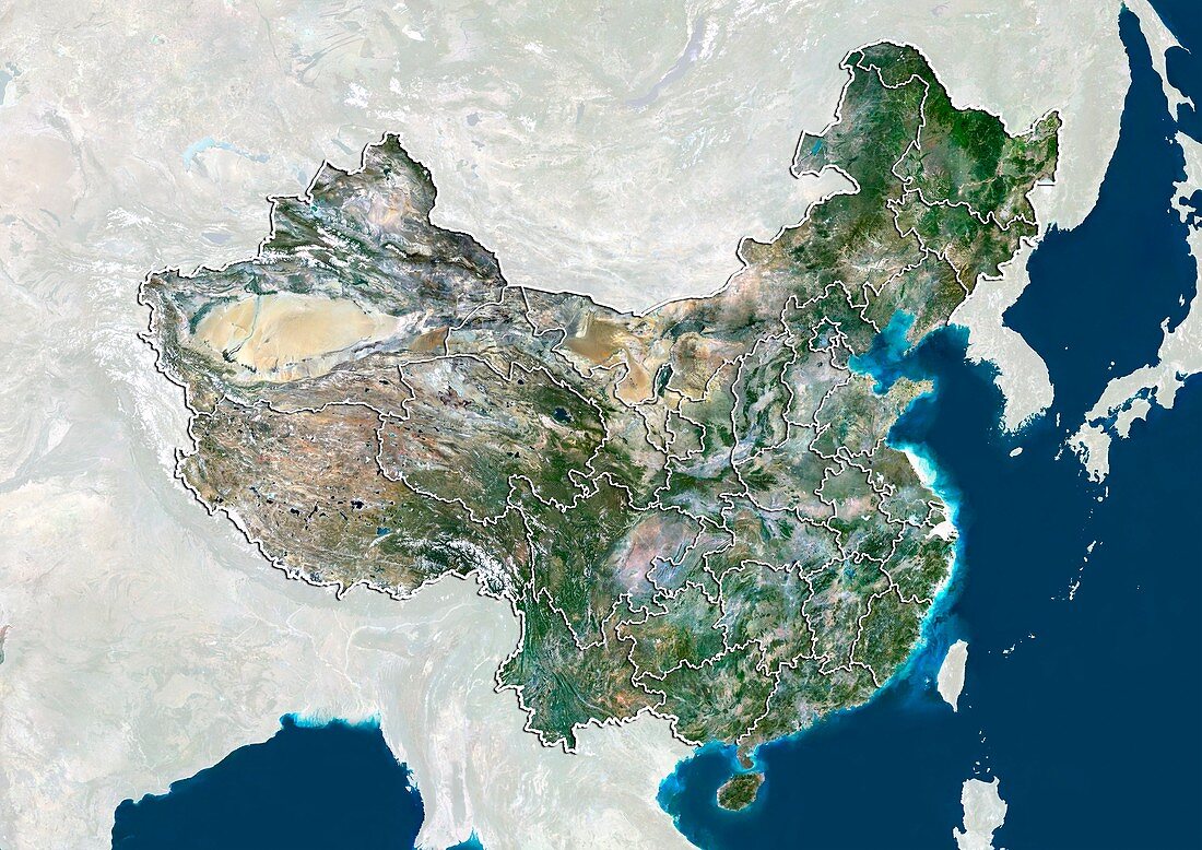
| China,satellite image. North is at top. Natural colour satellite image showing China divided into its provinces and regions. The East China Sea (blue),part of the Pacific Ocean,can be seen at left. The People's Republic of China exercises jurisdiction over 22 provinces,five autonomous regions,four directly controlled municipalities (Beijing,Tianjin,Shanghai,and Chongqing),and two mostly self-governing special administrative regions (Hong Kong and Macau). Image compiled from data acquired by the LANDSAT 5 and 7 satellites,in 2000 | |
| Lizenzart: | Lizenzpflichtig |
| Credit: | Science Photo Library / Planetobserver |
| Bildgröße: | 4995 px × 3535 px |
| Modell-Rechte: | nicht erforderlich |
| Restrictions: | - |
Preise für dieses Bild ab 15 €
Universitäten & Organisationen
(Informationsmaterial Digital, Informationsmaterial Print, Lehrmaterial Digital etc.)
ab 15 €
Redaktionell
(Bücher, Bücher: Sach- und Fachliteratur, Digitale Medien (redaktionell) etc.)
ab 30 €
Werbung
(Anzeigen, Aussenwerbung, Digitale Medien, Fernsehwerbung, Karten, Werbemittel, Zeitschriften etc.)
ab 55 €
Handelsprodukte
(bedruckte Textilie, Kalender, Postkarte, Grußkarte, Verpackung etc.)
ab 75 €
Pauschalpreise
Rechtepakete für die unbeschränkte Bildnutzung in Print oder Online
ab 495 €
Keywords
- 2000,
- 21. Jahrhundert,
- Asien,
- China,
- Chinesisch,
- Erdbeobachtung,
- geografisch,
- Geographie,
- Grenze,
- Grenzen,
- Karte,
- Kartographie,
- Küste,
- Küsten-,
- Küstenlinie,
- Land,
- Länder,
- Landsat 7,
- maskiert,
- Nation,
- Natur,
- Natürliche Farbe,
- Pazifik,
- Provinz,
- Rand,
- Satellit,
- Satellitenbild,
- Staat,
- Südchinesisches Meer,
- topografisch,
- Topographie,
- Ufer,
- Umwelt,
- Vogelperspektive,
- Von Oben,
- Weltall,
- wolkenlos