Earth,satellite image
Bildnummer 11633631
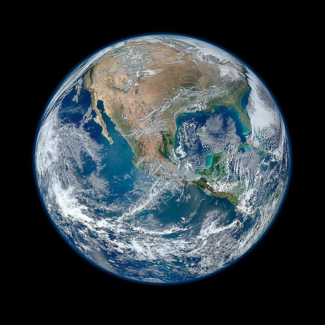
| Earth. Composite satellite image of Earth's Western hemisphere,showing the Americas from a perspective of 12,740 kilometres away. This image was compiled using data recorded by the Visible Infrared Imaging Radiometer Suite (VIIRS) on the Suomi NPP (National Polar-orbiting Partnership) satellite,during six separate orbits on 4th January 2012 | |
| Lizenzart: | Lizenzpflichtig |
| Credit: | Science Photo Library / NASA |
| Bildgröße: | 4193 px × 4193 px |
| Modell-Rechte: | nicht erforderlich |
| Restrictions: | - |
Preise für dieses Bild ab 15 €
Universitäten & Organisationen
(Informationsmaterial Digital, Informationsmaterial Print, Lehrmaterial Digital etc.)
ab 15 €
Redaktionell
(Bücher, Bücher: Sach- und Fachliteratur, Digitale Medien (redaktionell) etc.)
ab 30 €
Werbung
(Anzeigen, Aussenwerbung, Digitale Medien, Fernsehwerbung, Karten, Werbemittel, Zeitschriften etc.)
ab 55 €
Handelsprodukte
(bedruckte Textilie, Kalender, Postkarte, Grußkarte, Verpackung etc.)
ab 75 €
Pauschalpreise
Rechtepakete für die unbeschränkte Bildnutzung in Print oder Online
ab 495 €
Keywords
- 2012,
- 21. Jahrhundert,
- Atlantischer Ozean,
- ausgeschnitten,
- Ausschnitte,
- Erdbeobachtung,
- Erde,
- Erdkunde,
- geografisch,
- Geographie,
- Globus,
- Kreis,
- kreisförmig,
- Krümmung,
- Kurve,
- Land,
- Lateinamerika,
- Meer,
- NASA,
- Nordamerika,
- Oberfläche,
- Orbit,
- Ozean,
- Ozeane,
- Pazifik,
- Planet,
- Planetenwissenschaft,
- Raum,
- rund,
- Satellit,
- Satellitenbild,
- schwarzer Hintergrund,
- Sonnensystem,
- Südamerika,
- Suomi NPP,
- viirs,
- Welt,
- Weltall,
- weltweit,
- westliche Hemisphäre,
- Wolken,
- Wolkendecke,
- Zentralamerika