Uganda,satellite image
Bildnummer 11629553
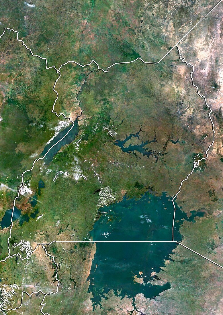
| Uganda,satellite image. North is at top. Natural colour satellite image showing Uganda (centre) and the surrounding territories. The Republic of Uganda is a landlocked country in East Africa. It is bordered by Kenya (right),South Sudan (top),the Democratic Republic of the Congo (DRC,left),Rwanda (lower left),and Tanzania (bottom). Lake Victoria (dark,lower right),which is shared by Kenya and Tanzania,Lake Kyoga (dark,centre) and Lake Albert (dark,upper left) can also be seen. Image compiled from data acquired by the LANDSAT 5 and 7 satellites,in 2000 | |
| Lizenzart: | Lizenzpflichtig |
| Credit: | Science Photo Library / Planetobserver |
| Bildgröße: | 3482 px × 4920 px |
| Modell-Rechte: | nicht erforderlich |
| Restrictions: | - |
Preise für dieses Bild ab 15 €
Universitäten & Organisationen
(Informationsmaterial Digital, Informationsmaterial Print, Lehrmaterial Digital etc.)
ab 15 €
Redaktionell
(Bücher, Bücher: Sach- und Fachliteratur, Digitale Medien (redaktionell) etc.)
ab 30 €
Werbung
(Anzeigen, Aussenwerbung, Digitale Medien, Fernsehwerbung, Karten, Werbemittel, Zeitschriften etc.)
ab 55 €
Handelsprodukte
(bedruckte Textilie, Kalender, Postkarte, Grußkarte, Verpackung etc.)
ab 75 €
Pauschalpreise
Rechtepakete für die unbeschränkte Bildnutzung in Print oder Online
ab 495 €
Keywords
- 2000,
- 21. Jahrhundert,
- Afrikanisch,
- Erdbeobachtung,
- geografisch,
- Geographie,
- Grenze,
- Grenzen,
- Große Seen,
- Karte,
- Kartographie,
- Kenia,
- Land,
- Länder,
- Landsat 7,
- Nation,
- Natur,
- Natürliche Farbe,
- Ostafrika,
- Rand,
- Ruanda,
- Satellit,
- Satellitenbild,
- Staat,
- Tansania,
- topografisch,
- Topographie,
- Uganda,
- Umwelt,
- Vogelperspektive,
- Von Oben,
- Weltall