Trinidad and Tobago,satellite image
Bildnummer 11629546
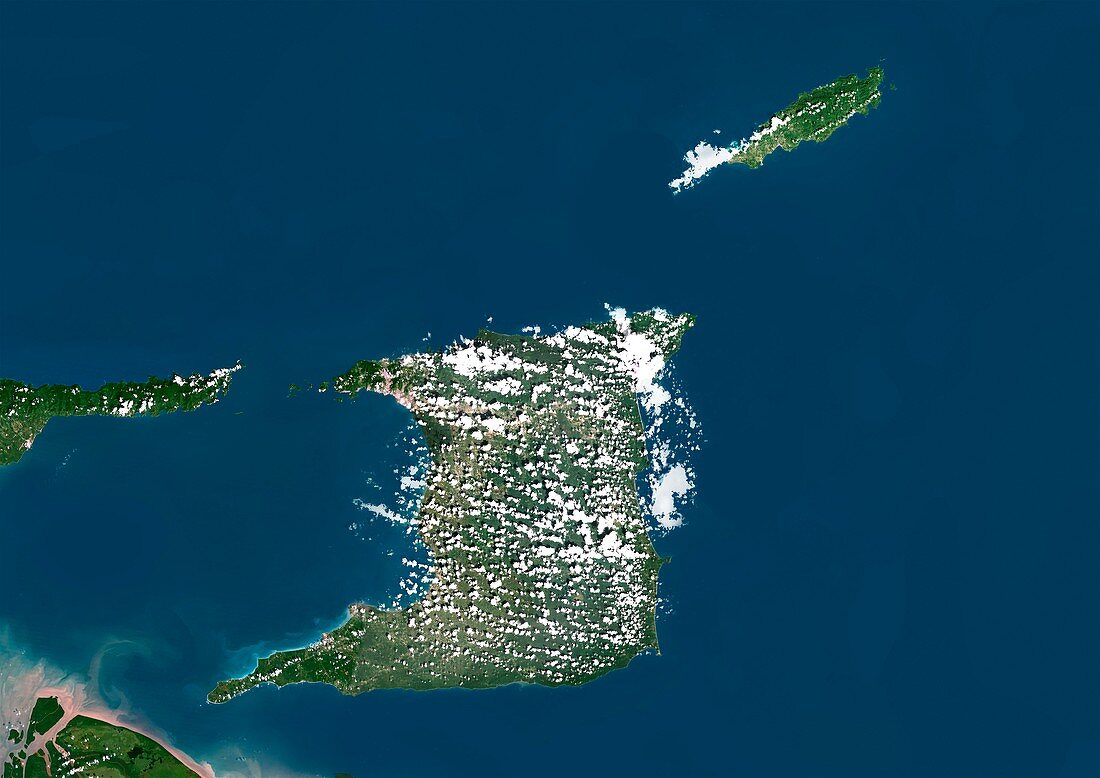
| Trinidad and Tobago,satellite image. North is at top. Natural colour satellite image showing the island nation of Trinidad and Tobago. The Republic of Trinidad and Tobago is an archipelago situated where the southern Caribbean Sea (blue,upper left) meets the North Atlantic Ocean (blue,lower right). It lies just off the coast of northeastern Venezuela (left and bottom left),across the Gulf of Paria (blue,lower left),in the Lesser Antilles of the West Indies. The northernmost island (upper right) is Tobago and the southermost (lower centre) is Trinidad. Image compiled from data acquired by the LANDSAT 5 and 7 satellites,in 2000 | |
| Lizenzart: | Lizenzpflichtig |
| Credit: | Science Photo Library / Planetobserver |
| Bildgröße: | 4919 px × 3481 px |
| Modell-Rechte: | nicht erforderlich |
| Restrictions: | - |
Preise für dieses Bild ab 15 €
Universitäten & Organisationen
(Informationsmaterial Digital, Informationsmaterial Print, Lehrmaterial Digital etc.)
ab 15 €
Redaktionell
(Bücher, Bücher: Sach- und Fachliteratur, Digitale Medien (redaktionell) etc.)
ab 30 €
Werbung
(Anzeigen, Aussenwerbung, Digitale Medien, Fernsehwerbung, Karten, Werbemittel, Zeitschriften etc.)
ab 55 €
Handelsprodukte
(bedruckte Textilie, Kalender, Postkarte, Grußkarte, Verpackung etc.)
ab 75 €
Pauschalpreise
Rechtepakete für die unbeschränkte Bildnutzung in Print oder Online
ab 495 €
Keywords
- 2000,
- 21. Jahrhundert,
- Archipel,
- Erdbeobachtung,
- geografisch,
- Geographie,
- Grenze,
- Grenzen,
- Insel,
- Inseln,
- Karte,
- Kartographie,
- Kette,
- Küste,
- Küsten-,
- Küstenlinie,
- Land,
- Länder,
- Landsat 7,
- Nation,
- Natur,
- Natürliche Farbe,
- Rand,
- Satellit,
- Satellitenbild,
- Staat,
- Südamerika,
- Südamerikanisch,
- topografisch,
- Topographie,
- Trinidad und Tobago,
- Ufer,
- Umwelt,
- Venezuela,
- Vogelperspektive,
- Von Oben,
- Weltall,
- Westindische Inseln