Sweden,satellite image
Bildnummer 11629530
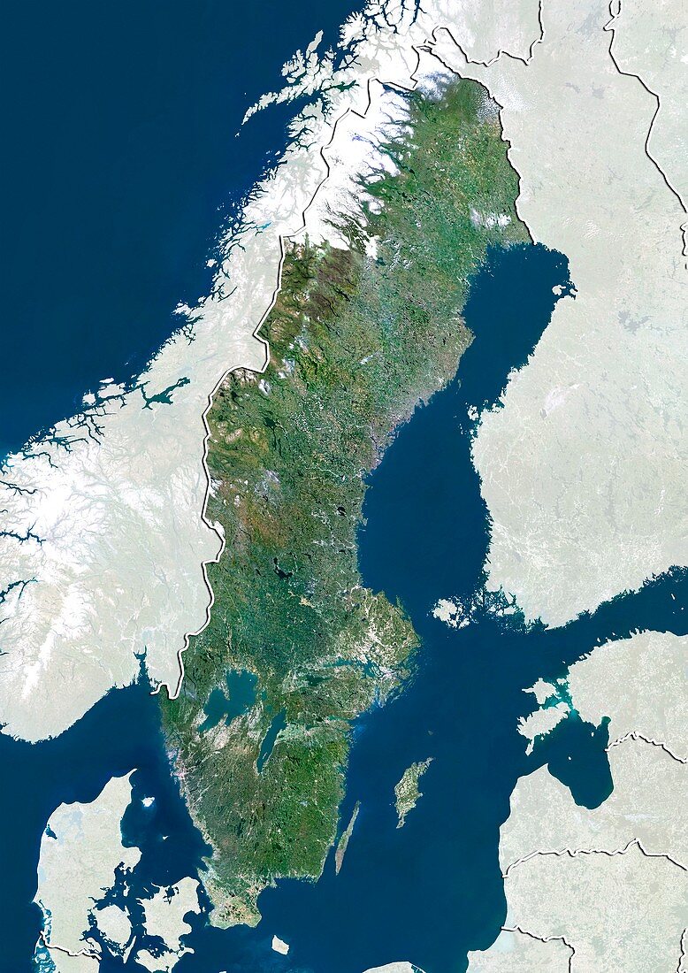
| Sweden,satellite image. North is at top. Natural colour satellite image showing Sweden,with the surrounding territories shaded out. Sweden is a Nordic on the Scandinavian Peninsula in Northern Europe. It is bordered by Norway (left) and Finland (right) and is connected to Denmark (bottom left) by a bridge-tunnel across the Oresund (blue,bottom left). The Skagerrak Strait (blue,lower left) separates Norway and Sweden from Denmark. The Norwegian Sea (blue upper left) and Gulf of Bothnia (blue,upper centre) - part of the Baltic Sea (blue,lower right),can also be seen. Image compiled from data acquired by the LANDSAT 5 and 7 satellites,in 2000 | |
| Lizenzart: | Lizenzpflichtig |
| Credit: | Science Photo Library / Planetobserver |
| Bildgröße: | 3482 px × 4920 px |
| Modell-Rechte: | nicht erforderlich |
| Restrictions: | - |
Preise für dieses Bild ab 15 €
Universitäten & Organisationen
(Informationsmaterial Digital, Informationsmaterial Print, Lehrmaterial Digital etc.)
ab 15 €
Redaktionell
(Bücher, Bücher: Sach- und Fachliteratur, Digitale Medien (redaktionell) etc.)
ab 30 €
Werbung
(Anzeigen, Aussenwerbung, Digitale Medien, Fernsehwerbung, Karten, Werbemittel, Zeitschriften etc.)
ab 55 €
Handelsprodukte
(bedruckte Textilie, Kalender, Postkarte, Grußkarte, Verpackung etc.)
ab 75 €
Pauschalpreise
Rechtepakete für die unbeschränkte Bildnutzung in Print oder Online
ab 495 €
Keywords
- 2000,
- 21. Jahrhundert,
- Erdbeobachtung,
- Europa,
- europäisch,
- Finnland,
- geografisch,
- Geographie,
- Grenze,
- Grenzen,
- Karte,
- Kartographie,
- Küste,
- Küsten-,
- Küstenlinie,
- Land,
- Länder,
- Landsat 7,
- maskiert,
- Nation,
- Natur,
- Natürliche Farbe,
- Nordeuropa,
- Nordisch,
- Norwegen,
- Ostsee,
- Rand,
- Region,
- Satellit,
- Satellitenbild,
- Schweden,
- Skandinavien,
- Staat,
- topografisch,
- Topographie,
- Ufer,
- Umwelt,
- Vogelperspektive,
- Von Oben,
- Wasser,
- Weltall