South Africa,satellite image
Bildnummer 11629514
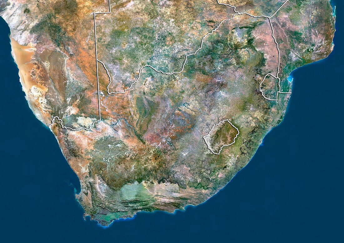
| South Africa,satellite image. North is at top. Natural colour satellite image showing South Africa (centre) and the surrounding territories. South Africa is a country located at the southern tip of Africa. It is bordered by Namibia (upper left),Botswana (top centre),Zimbabwe (top right),Mozambique (upper right),and Swaziland (small,upper right); while Lesotho (small,centre right) is an enclave entirely surrounded by South Africa. The Atlantic Ocean (blue,left) and Indian Ocean (blue,right) are also seen. Image compiled from data acquired by the LANDSAT 5 and 7 satellites,in 2000 | |
| Lizenzart: | Lizenzpflichtig |
| Credit: | Science Photo Library / Planetobserver |
| Bildgröße: | 4919 px × 3481 px |
| Modell-Rechte: | nicht erforderlich |
| Restrictions: | - |
Preise für dieses Bild ab 15 €
Universitäten & Organisationen
(Informationsmaterial Digital, Informationsmaterial Print, Lehrmaterial Digital etc.)
ab 15 €
Redaktionell
(Bücher, Bücher: Sach- und Fachliteratur, Digitale Medien (redaktionell) etc.)
ab 30 €
Werbung
(Anzeigen, Aussenwerbung, Digitale Medien, Fernsehwerbung, Karten, Werbemittel, Zeitschriften etc.)
ab 55 €
Handelsprodukte
(bedruckte Textilie, Kalender, Postkarte, Grußkarte, Verpackung etc.)
ab 75 €
Pauschalpreise
Rechtepakete für die unbeschränkte Bildnutzung in Print oder Online
ab 495 €
Keywords
- 2000,
- 21. Jahrhundert,
- Afrika,
- Afrikanisch,
- Atlantischer Ozean,
- Botswana,
- Erdbeobachtung,
- geografisch,
- Geographie,
- Grenze,
- Grenzen,
- Indischer Ozean,
- Kap der guten Hoffnung,
- Karte,
- Kartographie,
- Land,
- Länder,
- Landsat 7,
- Nation,
- Natur,
- Natürliche Farbe,
- Rand,
- Ratschlag,
- Satellit,
- Satellitenbild,
- Staat,
- Südafrika,
- topografisch,
- Topographie,
- Umwelt,
- Vogelperspektive,
- Von Oben,
- Weltall,
- Zimbabwe