Samoa,satellite image
Bildnummer 11629496
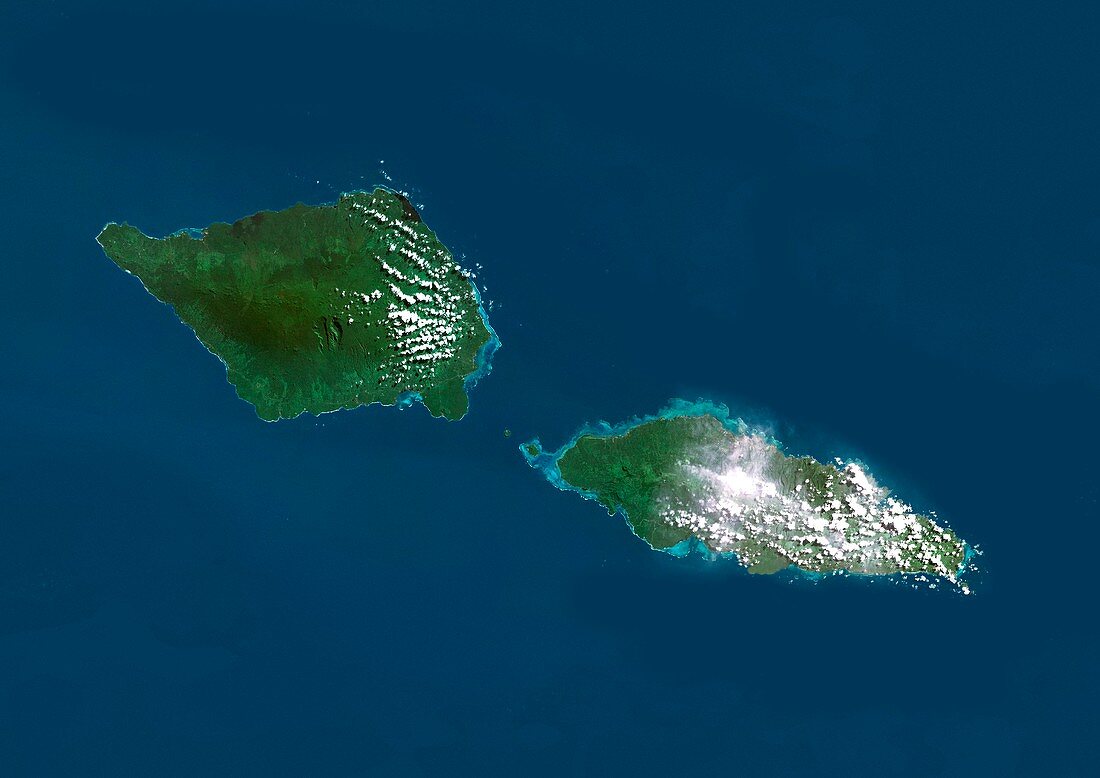
| Samoa,satellite image. North is at top. Natural colour satellite image showing the island nation of Samoa. This country lies south of the equator,about halfway between Hawai'i and New Zealand in the Polynesian region of the South Pacific Ocean (blue). It encompasses the western part of the Samoan Islands and consists of the two main islands,Upolu and Savai'i,and eight small islets. Image compiled from data acquired by the LANDSAT 5 and 7 satellites,in 2000 | |
| Lizenzart: | Lizenzpflichtig |
| Credit: | Science Photo Library / Planetobserver |
| Bildgröße: | 4919 px × 3481 px |
| Modell-Rechte: | nicht erforderlich |
| Restrictions: | - |
Preise für dieses Bild ab 15 €
Universitäten & Organisationen
(Informationsmaterial Digital, Informationsmaterial Print, Lehrmaterial Digital etc.)
ab 15 €
Redaktionell
(Bücher, Bücher: Sach- und Fachliteratur, Digitale Medien (redaktionell) etc.)
ab 30 €
Werbung
(Anzeigen, Aussenwerbung, Digitale Medien, Fernsehwerbung, Karten, Werbemittel, Zeitschriften etc.)
ab 55 €
Handelsprodukte
(bedruckte Textilie, Kalender, Postkarte, Grußkarte, Verpackung etc.)
ab 75 €
Pauschalpreise
Rechtepakete für die unbeschränkte Bildnutzung in Print oder Online
ab 495 €
Keywords
- 2000,
- 21. Jahrhundert,
- Erdbeobachtung,
- geografisch,
- Geographie,
- Grenze,
- Grenzen,
- Insel,
- Inseln,
- Karte,
- Kartographie,
- Küste,
- Küsten-,
- Küstenlinie,
- Land,
- Länder,
- Landsat 7,
- Nation,
- Natur,
- Natürliche Farbe,
- Pazifik,
- Polynesien,
- Rand,
- Samoa,
- Satellit,
- Satellitenbild,
- Staat,
- topografisch,
- Topographie,
- Ufer,
- Umwelt,
- Vogelperspektive,
- Von Oben,
- Wasser,
- Weltall