Papua New Guinea,satellite image
Bildnummer 11629467
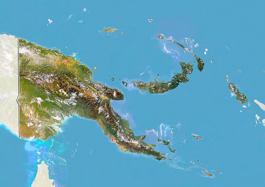
| Papua New Guinea,satellite image. North is at top. Natural colour satellite image showing Papua New Guinea,with the surrounding territories shaded out. Papua New Guinea is an island nation in the southwestern Pacific Ocean (blue),that occupies the eastern half of the island of New Guinea (large,centre left) and numerous offshore islands. It shares New Guinea with the Indonesian province of Papua (far left),and is located in a region known as Melanesia,part of Oceania. Image compiled from data acquired by the LANDSAT 5 and 7 satellites,in 2000 | |
| Lizenzart: | Lizenzpflichtig |
| Credit: | Science Photo Library / Planetobserver |
| Bildgröße: | 4919 px × 3481 px |
| Modell-Rechte: | nicht erforderlich |
| Restrictions: | - |
Preise für dieses Bild ab 15 €
Universitäten & Organisationen
(Informationsmaterial Digital, Informationsmaterial Print, Lehrmaterial Digital etc.)
ab 15 €
Redaktionell
(Bücher, Bücher: Sach- und Fachliteratur, Digitale Medien (redaktionell) etc.)
ab 30 €
Werbung
(Anzeigen, Aussenwerbung, Digitale Medien, Fernsehwerbung, Karten, Werbemittel, Zeitschriften etc.)
ab 55 €
Handelsprodukte
(bedruckte Textilie, Kalender, Postkarte, Grußkarte, Verpackung etc.)
ab 75 €
Pauschalpreise
Rechtepakete für die unbeschränkte Bildnutzung in Print oder Online
ab 495 €
Keywords
- 2000,
- 21. Jahrhundert,
- Asiatisch,
- Asien,
- Erdbeobachtung,
- geografisch,
- Geographie,
- Grenze,
- Grenzen,
- Indonesien,
- Indonesisch,
- indopazifisch,
- Insel,
- Inseln,
- Karte,
- Kartographie,
- Küste,
- Küsten-,
- Küstenlinie,
- Land,
- Länder,
- Landsat 7,
- maskiert,
- Nation,
- Natur,
- Natürliche Farbe,
- Ozeanien,
- Pazifik,
- Provinz,
- Rand,
- Satellit,
- Satellitenbild,
- Staat,
- Südostasien,
- topografisch,
- Topographie,
- Ufer,
- Umwelt,
- Vogelperspektive,
- Von Oben,
- Weltall