Schrodinger basin,lunar map
Bildnummer 11624039
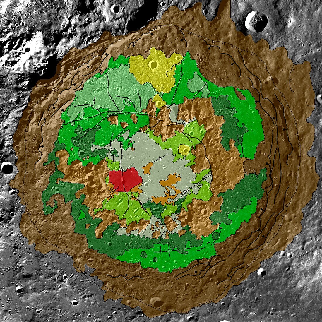
| Schrodinger basin,lunar map. Geologic map of the moon's Schrodinger basin,an impact crater located near the moon's south pole. The crater measures roughly 320 kilometres wide. The map combines topographic data from the Lunar Orbiter Laser Altimeter (from the 2009 Lunar Reconnaissance Orbiter) with data from earlier Clementine and Lunar Prospector missions. Colours represent rock type. The peak ring is coloured brown,recent volcanic activity coloured red,cratering is yellow and plains material is coloured dark and light green | |
| Lizenzart: | Lizenzpflichtig |
| Credit: | Science Photo Library / US Geological Survey |
| Bildgröße: | 2988 px × 2988 px |
| Modell-Rechte: | nicht erforderlich |
| Eigentums-Rechte: | nicht erforderlich |
| Restrictions: | - |
Preise für dieses Bild ab 15 €
Universitäten & Organisationen
(Informationsmaterial Digital, Informationsmaterial Print, Lehrmaterial Digital etc.)
ab 15 €
Redaktionell
(Bücher, Bücher: Sach- und Fachliteratur, Digitale Medien (redaktionell) etc.)
ab 30 €
Werbung
(Anzeigen, Aussenwerbung, Digitale Medien, Fernsehwerbung, Karten, Werbemittel, Zeitschriften etc.)
ab 55 €
Handelsprodukte
(bedruckte Textilie, Kalender, Postkarte, Grußkarte, Verpackung etc.)
ab 75 €
Pauschalpreise
Rechtepakete für die unbeschränkte Bildnutzung in Print oder Online
ab 495 €