Ivory Coast,satellite image
Bildnummer 11623951
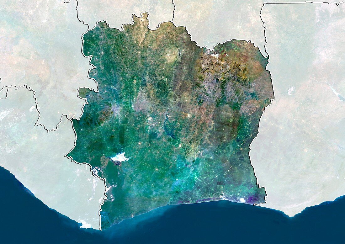
| Ivory Coast,satellite image. North is at top. Natural colour satellite image showing Ivory Coast,with the surrounding territories shaded out. Ivory Coast (Cote D'Ivoire) is a country in West Africa. It is bordered by Liberia (lower left),Guinea (upper left),Mali (top left),Burkina Faso (top right),Ghana (right),and the Gulf of Guinea (blue,lower centre) - part of the Atlantic Ocean. Image compiled from data acquired by the LANDSAT 5 and 7 satellites,in 2000 | |
| Lizenzart: | Lizenzpflichtig |
| Credit: | Science Photo Library / Planetobserver |
| Bildgröße: | 4919 px × 3481 px |
| Modell-Rechte: | nicht erforderlich |
| Restrictions: | - |
Preise für dieses Bild ab 15 €
Universitäten & Organisationen
(Informationsmaterial Digital, Informationsmaterial Print, Lehrmaterial Digital etc.)
ab 15 €
Redaktionell
(Bücher, Bücher: Sach- und Fachliteratur, Digitale Medien (redaktionell) etc.)
ab 30 €
Werbung
(Anzeigen, Aussenwerbung, Digitale Medien, Fernsehwerbung, Karten, Werbemittel, Zeitschriften etc.)
ab 55 €
Handelsprodukte
(bedruckte Textilie, Kalender, Postkarte, Grußkarte, Verpackung etc.)
ab 75 €
Pauschalpreise
Rechtepakete für die unbeschränkte Bildnutzung in Print oder Online
ab 495 €
Keywords
- 2000,
- 21. Jahrhundert,
- Afrika,
- Afrikanisch,
- Atlantischer Ozean,
- Elfenbeinküste,
- Erdbeobachtung,
- geografisch,
- Geographie,
- Ghana,
- Golf von Guinea,
- Grenze,
- Grenzen,
- Karte,
- Kartographie,
- Küste,
- Küsten-,
- Küstenlinie,
- Land,
- Länder,
- Landsat 7,
- Mali,
- maskiert,
- Meer,
- Nation,
- Natur,
- Natürliche Farbe,
- Rand,
- Satellit,
- Satellitenbild,
- Staat,
- topografisch,
- Topographie,
- Ufer,
- Umwelt,
- Vogelperspektive,
- Von Oben,
- Wasser,
- Weltall,
- Westafrika,
- wolkenlos