Iran,satellite image
Bildnummer 11623942
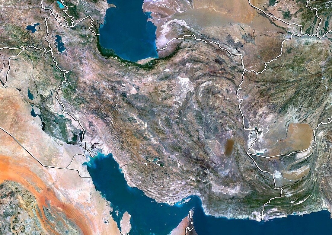
| Iran,satellite image. North is at top. Natural colour satellite image showing Iran (centre),the surrounding territories,the Caspian Sea (blue,top),Persian Gulf (blue,bottom left) and Gulf of Oman (bottom right). Iran is located in Southern and Western Asia. It is bordered by (clockwise from top left) Armenia,Azerbaijan,Turkmenistan,Afghanistan,Pakistan,Iraq,and Turkey. Image compiled from data acquired by the LANDSAT 5 and 7 satellites,in 2000 | |
| Lizenzart: | Lizenzpflichtig |
| Credit: | Science Photo Library / Planetobserver |
| Bildgröße: | 4919 px × 3481 px |
| Modell-Rechte: | nicht erforderlich |
| Restrictions: | - |
Preise für dieses Bild ab 15 €
Universitäten & Organisationen
(Informationsmaterial Digital, Informationsmaterial Print, Lehrmaterial Digital etc.)
ab 15 €
Redaktionell
(Bücher, Bücher: Sach- und Fachliteratur, Digitale Medien (redaktionell) etc.)
ab 30 €
Werbung
(Anzeigen, Aussenwerbung, Digitale Medien, Fernsehwerbung, Karten, Werbemittel, Zeitschriften etc.)
ab 55 €
Handelsprodukte
(bedruckte Textilie, Kalender, Postkarte, Grußkarte, Verpackung etc.)
ab 75 €
Pauschalpreise
Rechtepakete für die unbeschränkte Bildnutzung in Print oder Online
ab 495 €
Keywords
- 2000,
- 21. Jahrhundert,
- Afghanistan,
- Armenien,
- Aserbaidschan,
- Asiatisch,
- Asien,
- Berg,
- bergig,
- Erdbeobachtung,
- gebirgig,
- geografisch,
- Geographie,
- Golf von Oman,
- Grenze,
- Grenzen,
- Irak,
- Iran,
- Karte,
- Kartographie,
- Kaspisches Meer,
- Küste,
- Küsten-,
- Küstenlinie,
- Land,
- Länder,
- Landsat 7,
- maskiert,
- Mittlerer Osten,
- Nahost,
- Nation,
- Natur,
- Natürliche Farbe,
- Pakistan,
- Persien,
- Persischer Golf,
- Rand,
- Satellit,
- Satellitenbild,
- Staat,
- topografisch,
- Topographie,
- Truthahn,
- Turkmenistan,
- Ufer,
- Umwelt,
- Vogelperspektive,
- Von Oben,
- Wasser,
- Weltall,
- wolkenlos