Indonesia,satellite image
Bildnummer 11623939
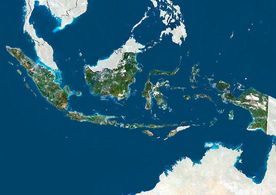
| Indonesia,satellite image. North is at top. Natural colour satellite image showing Indonesia,with the surrounding territories shaded out,the Indian Ocean (blue,bottom left) and Pacific Ocean (upper right). Indonesia is an archipelago in Southeast Asia and Oceania and comprising approximately 17,508 islands,with 33 provinces. The country shares land borders with Papua New Guinea (far right),East Timor (lower centre right),and Malaysia (upper centre to upper right). Other neighbouring countries include the Philippines (top centre) and Australia (bottom right). Image compiled from data acquired by the LANDSAT 5 and 7 satellites,in 2000 | |
| Lizenzart: | Lizenzpflichtig |
| Credit: | Science Photo Library / Planetobserver |
| Bildgröße: | 4919 px × 3481 px |
| Modell-Rechte: | nicht erforderlich |
| Restrictions: | - |
Preise für dieses Bild ab 15 €
Universitäten & Organisationen
(Informationsmaterial Digital, Informationsmaterial Print, Lehrmaterial Digital etc.)
ab 15 €
Redaktionell
(Bücher, Bücher: Sach- und Fachliteratur, Digitale Medien (redaktionell) etc.)
ab 30 €
Werbung
(Anzeigen, Aussenwerbung, Digitale Medien, Fernsehwerbung, Karten, Werbemittel, Zeitschriften etc.)
ab 55 €
Handelsprodukte
(bedruckte Textilie, Kalender, Postkarte, Grußkarte, Verpackung etc.)
ab 75 €
Pauschalpreise
Rechtepakete für die unbeschränkte Bildnutzung in Print oder Online
ab 495 €
Keywords
- 2000,
- 21. Jahrhundert,
- Archipel,
- Asiatisch,
- Asien,
- Australien,
- Erdbeobachtung,
- geografisch,
- Geographie,
- Grenze,
- Grenzen,
- Indischer Ozean,
- Indonesien,
- indopazifisch,
- Insel,
- Inseln,
- Karte,
- Kartographie,
- Küste,
- Küsten-,
- Küstenlinie,
- Land,
- Länder,
- Landsat 7,
- Malaysia,
- maskiert,
- Nation,
- Natur,
- Natürliche Farbe,
- Osttimor,
- Ozeanien,
- Pazifik,
- Philippinen,
- Provinz,
- Rand,
- Satellit,
- Satellitenbild,
- Staat,
- Südostasien,
- topografisch,
- Topographie,
- Ufer,
- Umwelt,
- Vogelperspektive,
- Von Oben,
- Weltall,
- wolkenlos