Honduras,satellite image
Bildnummer 11623932
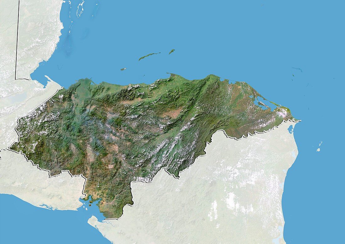
| Honduras,satellite image. North is at top. Natural colour satellite image showing Honduras,with the surrounding territories shaded out. Honduras is located in Central America. It is bordered by Guatemala (upper left),El Salvador (lower left) and Nicaragua (lower right). To the south is the Gulf of Fonseca (blue,bottom left) - part of the Pacific Ocean,and to the north is the Gulf of Honduras (blue,top) - a large inlet of the Caribbean Sea (blue,right). Image compiled from data acquired by the LANDSAT 5 and 7 satellites,in 2000 | |
| Lizenzart: | Lizenzpflichtig |
| Credit: | Science Photo Library / Planetobserver |
| Bildgröße: | 4919 px × 3481 px |
| Modell-Rechte: | nicht erforderlich |
| Restrictions: | - |
Preise für dieses Bild ab 15 €
Universitäten & Organisationen
(Informationsmaterial Digital, Informationsmaterial Print, Lehrmaterial Digital etc.)
ab 15 €
Redaktionell
(Bücher, Bücher: Sach- und Fachliteratur, Digitale Medien (redaktionell) etc.)
ab 30 €
Werbung
(Anzeigen, Aussenwerbung, Digitale Medien, Fernsehwerbung, Karten, Werbemittel, Zeitschriften etc.)
ab 55 €
Handelsprodukte
(bedruckte Textilie, Kalender, Postkarte, Grußkarte, Verpackung etc.)
ab 75 €
Pauschalpreise
Rechtepakete für die unbeschränkte Bildnutzung in Print oder Online
ab 495 €
Keywords
- 2000,
- 21. Jahrhundert,
- El Salvador,
- Erdbeobachtung,
- geografisch,
- Geographie,
- Golf von Fonseca,
- Grenze,
- Grenzen,
- Guatemala,
- Honduras,
- Karibisches Meer,
- Karte,
- Kartographie,
- Küste,
- Küsten-,
- Küstenlinie,
- Land,
- Länder,
- Landsat 7,
- maskiert,
- Mittelamerika,
- Nation,
- Natur,
- Natürliche Farbe,
- Pazifik,
- Rand,
- Satellit,
- Satellitenbild,
- Staat,
- topografisch,
- Topographie,
- Ufer,
- Umwelt,
- Vogelperspektive,
- Von Oben,
- Wasser,
- Weltall,
- wolkenlos,
- Zentralamerika