Finland,satellite image
Bildnummer 11623902
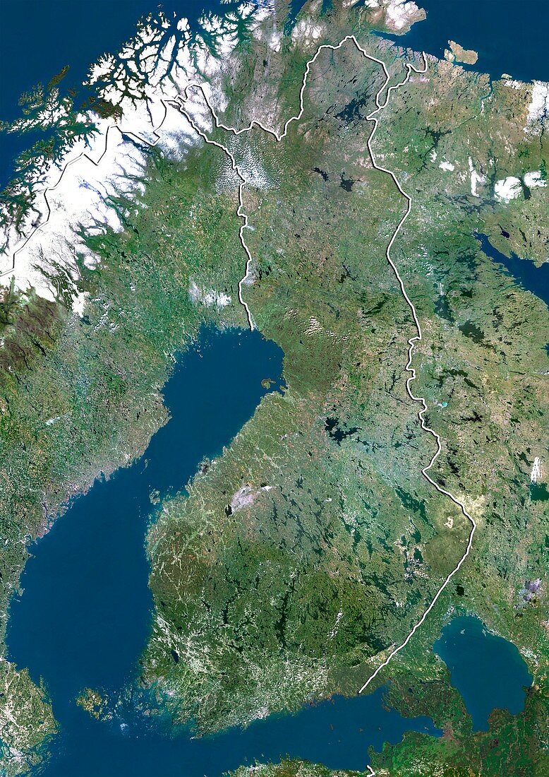
| Finland,satellite image. North is at top. Natural colour satellite image showing Finland (centre) and the surrounding territories. Finland is a Nordic country situated in the Fennoscandian region of Northern Europe. It is bordered by Sweden (left),Norway (upper centre) and Russia (right). Estonia (bottom centre) lies across the Gulf of Finland (blue,bottom centre). The Gulf of Bothnia (blue,centre left) - part of the Baltic Sea - can also be seen; as can the Norwegian Sea (blue,top left) and Berents Sea (blue,top right). Image compiled from data acquired by the LANDSAT 5 and 7 satellites,in 2000 | |
| Lizenzart: | Lizenzpflichtig |
| Credit: | Science Photo Library / Planetobserver |
| Bildgröße: | 3482 px × 4920 px |
| Modell-Rechte: | nicht erforderlich |
| Restrictions: | - |
Preise für dieses Bild ab 15 €
Universitäten & Organisationen
(Informationsmaterial Digital, Informationsmaterial Print, Lehrmaterial Digital etc.)
ab 15 €
Redaktionell
(Bücher, Bücher: Sach- und Fachliteratur, Digitale Medien (redaktionell) etc.)
ab 30 €
Werbung
(Anzeigen, Aussenwerbung, Digitale Medien, Fernsehwerbung, Karten, Werbemittel, Zeitschriften etc.)
ab 55 €
Handelsprodukte
(bedruckte Textilie, Kalender, Postkarte, Grußkarte, Verpackung etc.)
ab 75 €
Pauschalpreise
Rechtepakete für die unbeschränkte Bildnutzung in Print oder Online
ab 495 €
Keywords
- 2000,
- 21. Jahrhundert,
- Erdbeobachtung,
- Estland,
- Europa,
- europäisch,
- Finnland,
- geografisch,
- Geographie,
- Grenze,
- Grenzen,
- Karte,
- Kartographie,
- Küste,
- Küsten-,
- Küstenlinie,
- Land,
- Länder,
- Landsat 7,
- Nation,
- Natur,
- Natürliche Farbe,
- Nordeuropa,
- Nordisch,
- Norwegen,
- Ostsee,
- Rand,
- Region,
- Russland,
- Satellit,
- Satellitenbild,
- Schweden,
- Skandinavien,
- Staat,
- topografisch,
- Topographie,
- Ufer,
- Umwelt,
- Vogelperspektive,
- Von Oben,
- Wasser,
- Weltall,
- wolkenlos