Equatorial Guinea,satellite image
Bildnummer 11623890
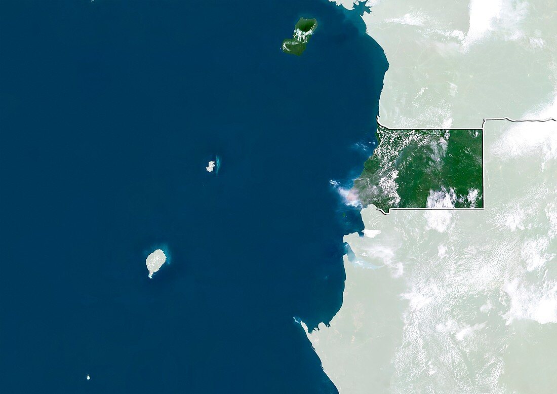
| Equatorial Guinea,satellite image. North is at top. Natural colour satellite image showing Equatorial Guinea,with the surrounding territories shaded out. Equatorial Guinea is located in Middle Africa and is bordered by Cameroon (upper right),Gabon (lower right),and the Gulf of Guinea (blue) - part of the Atlantic Ocean. Equatorial Guinea includes Annobon island (small dot,lower left) and Bioko island (upper centre). The Democratic Republic of Sao Tome and Principe (islands,centre left) can also be seen. Image compiled from data acquired by the LANDSAT 5 and 7 satellites,in 2000 | |
| Lizenzart: | Lizenzpflichtig |
| Credit: | Science Photo Library / Planetobserver |
| Bildgröße: | 4919 px × 3481 px |
| Modell-Rechte: | nicht erforderlich |
| Restrictions: | - |
Preise für dieses Bild ab 15 €
Universitäten & Organisationen
(Informationsmaterial Digital, Informationsmaterial Print, Lehrmaterial Digital etc.)
ab 15 €
Redaktionell
(Bücher, Bücher: Sach- und Fachliteratur, Digitale Medien (redaktionell) etc.)
ab 30 €
Werbung
(Anzeigen, Aussenwerbung, Digitale Medien, Fernsehwerbung, Karten, Werbemittel, Zeitschriften etc.)
ab 55 €
Handelsprodukte
(bedruckte Textilie, Kalender, Postkarte, Grußkarte, Verpackung etc.)
ab 75 €
Pauschalpreise
Rechtepakete für die unbeschränkte Bildnutzung in Print oder Online
ab 495 €
Keywords
- 2000,
- 21. Jahrhundert,
- Afrika,
- Afrikanisch,
- Atlantischer Ozean,
- Erdbeobachtung,
- geografisch,
- Geographie,
- Golf von Guinea,
- Grenze,
- Grenzen,
- Insel,
- Inseln,
- Kamerun,
- Karte,
- Kartographie,
- Küste,
- Küsten-,
- Küstenlinie,
- Land,
- Länder,
- Landsat 7,
- maskiert,
- Nation,
- Natur,
- Natürliche Farbe,
- Rand,
- Satellit,
- Satellitenbild,
- Staat,
- topografisch,
- Topographie,
- Ufer,
- Umwelt,
- Vogelperspektive,
- Von Oben,
- Wasser,
- Weltall