West side of the moon,geologic map
Bildnummer 11623738
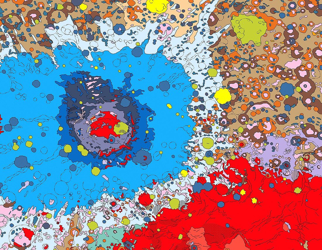
| West side of the moon. Geologic map of the moon based on photographs from the Lunar orbiter spacecraft and albedo (surface reflectivity) data from the Russian Zond 8 spacecraft. Regions are coloured according to reflectivity and correspond to surface features,such as major impact craters,basins,plains,faults,mountains and other landmarks. The large bull's-eye structure (red and blue,left of centre) is the Mare Orientale,an impact basin measuring 900 kilometres across | |
| Lizenzart: | Lizenzpflichtig |
| Credit: | Science Photo Library / US Geological Survey |
| Bildgröße: | 4760 px × 3706 px |
| Modell-Rechte: | nicht erforderlich |
| Eigentums-Rechte: | nicht erforderlich |
| Restrictions: | - |
Preise für dieses Bild ab 15 €
Universitäten & Organisationen
(Informationsmaterial Digital, Informationsmaterial Print, Lehrmaterial Digital etc.)
ab 15 €
Redaktionell
(Bücher, Bücher: Sach- und Fachliteratur, Digitale Medien (redaktionell) etc.)
ab 30 €
Werbung
(Anzeigen, Aussenwerbung, Digitale Medien, Fernsehwerbung, Karten, Werbemittel, Zeitschriften etc.)
ab 55 €
Handelsprodukte
(bedruckte Textilie, Kalender, Postkarte, Grußkarte, Verpackung etc.)
ab 75 €
Pauschalpreise
Rechtepakete für die unbeschränkte Bildnutzung in Print oder Online
ab 495 €