Mars north polar map
Bildnummer 11623734
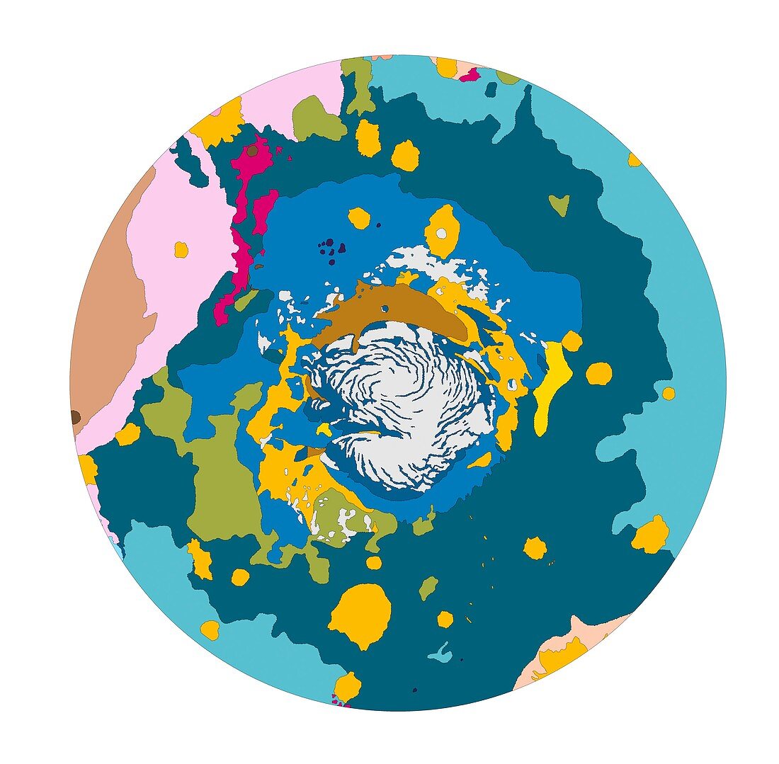
| Mars north polar map. Geologic map of Mars viewed from above the northern polar ice cap. This map is based on surveys from the Viking orbiter spacecrafts. Black lines outline the shapes of craters,basins,ridges,faults and other notable landmarks. Colours depict rock type (lithology),rock layers (stratigraphy) and structure. The northern ice cap measures roughly 600 kilometres in diameter. This permanent feature is composed of water ice and frozen carbon dioxide | |
| Lizenzart: | Lizenzpflichtig |
| Credit: | Science Photo Library / US Geological Survey |
| Bildgröße: | 5315 px × 5214 px |
| Modell-Rechte: | nicht erforderlich |
| Eigentums-Rechte: | nicht erforderlich |
| Restrictions: | - |
Preise für dieses Bild ab 15 €
Universitäten & Organisationen
(Informationsmaterial Digital, Informationsmaterial Print, Lehrmaterial Digital etc.)
ab 15 €
Redaktionell
(Bücher, Bücher: Sach- und Fachliteratur, Digitale Medien (redaktionell) etc.)
ab 30 €
Werbung
(Anzeigen, Aussenwerbung, Digitale Medien, Fernsehwerbung, Karten, Werbemittel, Zeitschriften etc.)
ab 55 €
Handelsprodukte
(bedruckte Textilie, Kalender, Postkarte, Grußkarte, Verpackung etc.)
ab 75 €
Pauschalpreise
Rechtepakete für die unbeschränkte Bildnutzung in Print oder Online
ab 495 €
Keywords
- 1,
- Atlas,
- Eis,
- farbig,
- Geologie,
- geologisch,
- Karte,
- Krater,
- Mars,
- Nordpol,
- Oberfläche,
- Planet,
- polar,
- Satellit,
- Satellitenbild,
- Sonnensystem