East Timor,satellite image
Bildnummer 11623432
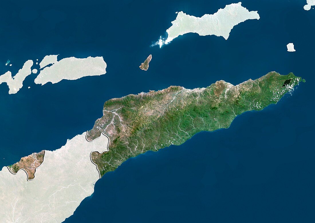
| East Timor,satellite image. North is at top. Natural colour satellite image showing East Timor with the surrounding territories shaded out. East Timor is located in Southeast Asia and comprises the eastern half of the island of Timor,the nearby islands of Atauro and Jaco,and Oecusse (small,lower left),an exclave on the northwestern side of the island,within Indonesian West Timor (lower left). It lies between the Banda Sea (blue,top) and Timor Sea (blue,bottom),within the Pacific Ocean,about 640 kilometres northwest of Darwin,Australia. Image compiled from data acquired by the LANDSAT 5 and 7 satellites,in 2000 | |
| Lizenzart: | Lizenzpflichtig |
| Credit: | Science Photo Library / Planetobserver |
| Bildgröße: | 4919 px × 3481 px |
| Modell-Rechte: | nicht erforderlich |
| Restrictions: | - |
Preise für dieses Bild ab 15 €
Universitäten & Organisationen
(Informationsmaterial Digital, Informationsmaterial Print, Lehrmaterial Digital etc.)
ab 15 €
Redaktionell
(Bücher, Bücher: Sach- und Fachliteratur, Digitale Medien (redaktionell) etc.)
ab 30 €
Werbung
(Anzeigen, Aussenwerbung, Digitale Medien, Fernsehwerbung, Karten, Werbemittel, Zeitschriften etc.)
ab 55 €
Handelsprodukte
(bedruckte Textilie, Kalender, Postkarte, Grußkarte, Verpackung etc.)
ab 75 €
Pauschalpreise
Rechtepakete für die unbeschränkte Bildnutzung in Print oder Online
ab 495 €
Keywords
- 2000,
- 21. Jahrhundert,
- Asiatisch,
- Asien,
- Erdbeobachtung,
- geografisch,
- Geographie,
- Grenze,
- Grenzen,
- Indonesisch,
- indopazifisch,
- Insel,
- Karte,
- Kartographie,
- Küste,
- Küsten-,
- Küstenlinie,
- Land,
- Länder,
- Landsat 7,
- maskiert,
- Nation,
- Natur,
- Natürliche Farbe,
- Osttimor,
- Rand,
- Satellit,
- Satellitenbild,
- Staat,
- Südostasien,
- topografisch,
- Topographie,
- Ufer,
- Umwelt,
- Vogelperspektive,
- Von Oben,
- Weltall,
- wolkenlos