Chile,satellite image
Bildnummer 11623267
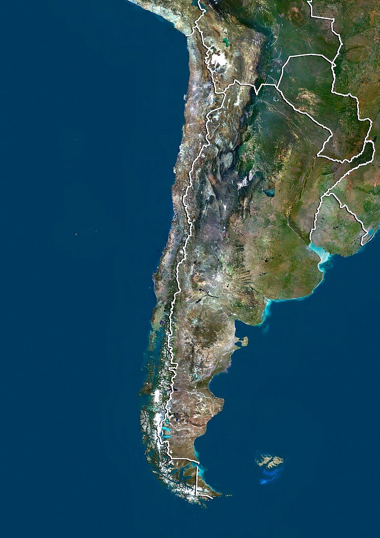
| Chile,satellite image. North is at top. Natural colour satellite image showing Chile (centre) and the surrounding territories. Chile is located in South America and occupies a long narrow strip of land between the Andes mountains to the east and the Pacific Ocean (blue) to the west. It borders Peru to the north,Bolivia to the northeast,Argentina to the east,and the Drake Passage in the far south. The Falkland Islands can also be seen (lower right). Image compiled from data acquired by the LANDSAT 5 and 7 satellites,in 2000 | |
| Lizenzart: | Lizenzpflichtig |
| Credit: | Science Photo Library / Planetobserver |
| Bildgröße: | 3482 px × 4920 px |
| Modell-Rechte: | nicht erforderlich |
| Restrictions: | - |
Preise für dieses Bild ab 15 €
Universitäten & Organisationen
(Informationsmaterial Digital, Informationsmaterial Print, Lehrmaterial Digital etc.)
ab 15 €
Redaktionell
(Bücher, Bücher: Sach- und Fachliteratur, Digitale Medien (redaktionell) etc.)
ab 30 €
Werbung
(Anzeigen, Aussenwerbung, Digitale Medien, Fernsehwerbung, Karten, Werbemittel, Zeitschriften etc.)
ab 55 €
Handelsprodukte
(bedruckte Textilie, Kalender, Postkarte, Grußkarte, Verpackung etc.)
ab 75 €
Pauschalpreise
Rechtepakete für die unbeschränkte Bildnutzung in Print oder Online
ab 495 €
Keywords
- 2000,
- 21. Jahrhundert,
- Anden,
- Argentinien,
- Argentinier,
- Argentinisches Meer,
- Atlantischer Ozean,
- Berg,
- Berge,
- bergig,
- Bolivien,
- Erdbeobachtung,
- gebirgig,
- geografisch,
- Geographie,
- Grenze,
- Grenzen,
- Karte,
- Kartographie,
- Küste,
- Küsten-,
- Küstenlinie,
- Land,
- Länder,
- Landsat 7,
- Meer,
- Nation,
- Natur,
- Natürliche Farbe,
- Pazifik,
- Peru,
- Rand,
- Reichweite,
- Satellit,
- Satellitenbild,
- Staat,
- Südamerika,
- Südamerikanisch,
- topografisch,
- Topographie,
- Ufer,
- Umwelt,
- Vogelperspektive,
- Von Oben,
- Wasser,
- Weltall,
- wolkenlos