Bangladesh,satellite image
Bildnummer 11623240
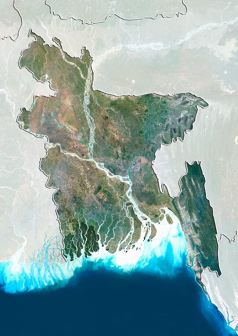
| Bangladesh,satellite image. North is at top. Natural colour satellite image showing Bangladesh,with the surrounding territories shaded out. Bangladesh is bordered by Myanmar (Burma,lower right),and the Indian states of Assam (upper right) and West Bengal (left),with the Bay of Bengal to the south (blue). Image compiled from data acquired by the LANDSAT 5 and 7 satellites,in 2000 | |
| Lizenzart: | Lizenzpflichtig |
| Credit: | Science Photo Library / Planetobserver |
| Bildgröße: | 3482 px × 4920 px |
| Modell-Rechte: | nicht erforderlich |
| Restrictions: | - |
Preise für dieses Bild ab 15 €
Universitäten & Organisationen
(Informationsmaterial Digital, Informationsmaterial Print, Lehrmaterial Digital etc.)
ab 15 €
Redaktionell
(Bücher, Bücher: Sach- und Fachliteratur, Digitale Medien (redaktionell) etc.)
ab 30 €
Werbung
(Anzeigen, Aussenwerbung, Digitale Medien, Fernsehwerbung, Karten, Werbemittel, Zeitschriften etc.)
ab 55 €
Handelsprodukte
(bedruckte Textilie, Kalender, Postkarte, Grußkarte, Verpackung etc.)
ab 75 €
Pauschalpreise
Rechtepakete für die unbeschränkte Bildnutzung in Print oder Online
ab 495 €
Keywords
- 2000,
- 21. Jahrhundert,
- Asiatisch,
- Asien,
- Assam,
- Birma,
- Erdbeobachtung,
- Fluss,
- geografisch,
- Geographie,
- Golf von Bengalen,
- Grenze,
- Grenzen,
- Indien,
- Indischer Ozean,
- Karte,
- Kartographie,
- Küste,
- Küsten-,
- Küstenlinie,
- Land,
- Länder,
- Landsat 7,
- maskiert,
- Meer,
- Myanmar,
- Nation,
- Natur,
- Natürliche Farbe,
- Rand,
- Satellit,
- Satellitenbild,
- Staat,
- topografisch,
- Topographie,
- Ufer,
- Umwelt,
- Vogelperspektive,
- Von Oben,
- Wasser,
- Weltall,
- wolkenlos