Thunderstorm detection chart,1953
Bildnummer 11618638
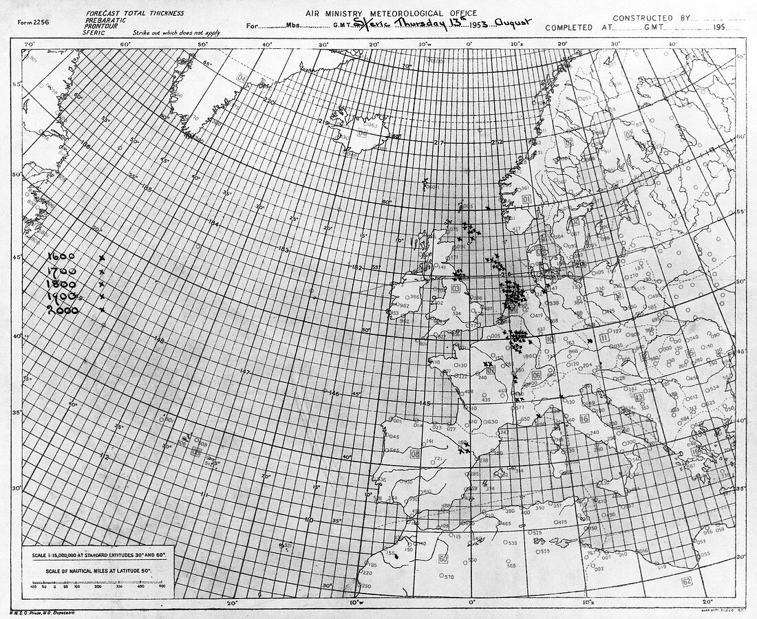
| Thunderstorm detection chart. Met Office chart showing the plotted location of thunderstorms (crosses) over the North Sea and Western Europe on 13 August 1953. The storms are detected by the radio noise (sferics) produced by lightning in the atmosphere. The radio noise and direction is obtained using cathode ray direction-finding systems. The Met Office is the UK's national weather monitoring and forecasting service. At the time this chart was prepared,it was part of the Air Ministry | |
| Lizenzart: | Lizenzpflichtig |
| Credit: | Science Photo Library / © BRITISH CROWN COPYRIGHT, THE MET OFFICE |
| Bildgröße: | 4671 px × 3820 px |
| Modell-Rechte: | nicht erforderlich |
| Eigentums-Rechte: | nicht erforderlich |
| Restrictions: | - |
Preise für dieses Bild ab 15 €
Universitäten & Organisationen
(Informationsmaterial Digital, Informationsmaterial Print, Lehrmaterial Digital etc.)
ab 15 €
Redaktionell
(Bücher, Bücher: Sach- und Fachliteratur, Digitale Medien (redaktionell) etc.)
ab 30 €
Werbung
(Anzeigen, Aussenwerbung, Digitale Medien, Fernsehwerbung, Karten, Werbemittel, Zeitschriften etc.)
ab 55 €
Handelsprodukte
(bedruckte Textilie, Kalender, Postkarte, Grußkarte, Verpackung etc.)
ab 75 €
Pauschalpreise
Rechtepakete für die unbeschränkte Bildnutzung in Print oder Online
ab 495 €
Keywords
- 1900er Jahre,
- 20. Jahrhundert,
- Blitz,
- britisch,
- Britische Inseln,
- Daten,
- Diagramm,
- Einfarbig,
- England,
- Englisch,
- Europa,
- europäisch,
- geografisch,
- Geographie,
- Geschichte,
- Gewitter,
- Großbritannien,
- historisch,
- Karte,
- Luftfahrtministerium,
- Meteorologie,
- meteorologisch,
- Nordatlantik,
- Nordsee,
- Schwarz und weiß,
- Sturm,
- Stürme,
- Vereinigtes Königreich