GOCE satellite construction,artwork
Bildnummer 11618129
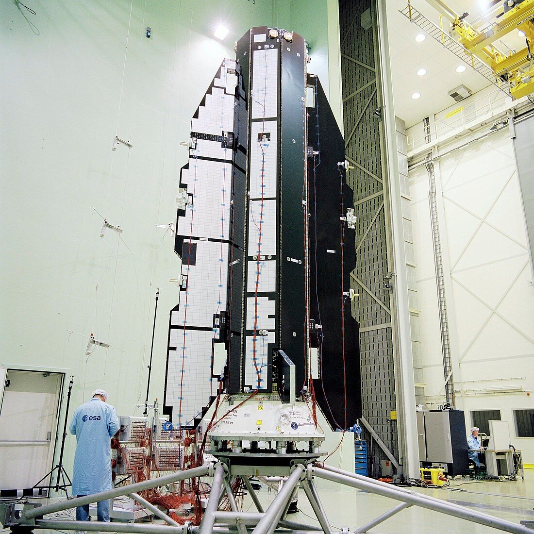
| GOCE satellite construction. ESA's (European Space Agency's) GOCE (Gravity Field and Steady-State Ocean Circulation Explorer) spacecraft undergoing acoustic tests at ESA's Technical Centre (ESTEC) in Noordwijk,The Netherlands. Since it's launch on 17th March 2009,the GOCE satellite has gathered enough data to map Earth's gravity with unrivalled precision. This has led to the most accurate model of the 'geoid' ever produced (as of 2011). The geoid is the surface of an ideal global ocean in the absence of tides and currents,shaped only by gravity | |
| Lizenzart: | Lizenzpflichtig |
| Credit: | Science Photo Library / Le Floc'h, Anneke / ESA |
| Bildgröße: | 2141 px × 2141 px |
| Modell-Rechte: | nicht erforderlich |
| Restrictions: |
|
Preise für dieses Bild ab 15 €
Universitäten & Organisationen
(Informationsmaterial Digital, Informationsmaterial Print, Lehrmaterial Digital etc.)
ab 15 €
Redaktionell
(Bücher, Bücher: Sach- und Fachliteratur, Digitale Medien (redaktionell) etc.)
ab 30 €
Werbung
(Anzeigen, Aussenwerbung, Digitale Medien, Fernsehwerbung, Karten, Werbemittel, Zeitschriften etc.)
ab 55 €
Handelsprodukte
(bedruckte Textilie, Kalender, Postkarte, Grußkarte, Verpackung etc.)
ab 75 €
Pauschalpreise
Rechtepakete für die unbeschränkte Bildnutzung in Print oder Online
ab 495 €
Keywords
- 21. Jahrhundert,
- Akustik,
- Arbeiter,
- aufbauend,
- Erdbeobachtung,
- Erkundung,
- Erwachsene,
- esa,
- estec,
- Europa,
- europäisch,
- Europäische Weltraumbehörde,
- Forschung,
- Gebäude,
- goce,
- Gravitation,
- Holland,
- Ingenieur,
- kaukasisch,
- Konstruktion,
- Mann,
- Männlich,
- Maschine,
- Mensch,
- Menschen,
- Messung,
- Mission,
- Niederlande,
- Niederländisch,
- noordwijk,
- Oberfläche,
- Person,
- Raum,
- Raumfahrzeug,
- Raumschiff,
- Satellit,
- Techniker,
- Technologie,
- technologisch,
- Test,
- Testen,
- Tests,
- Überwachung,
- umkreisend,
- weiß,
- Weltraumflug,
- Wissenschaft,
- wissenschaftlich