Tornado track,satellite image
Bildnummer 11614305
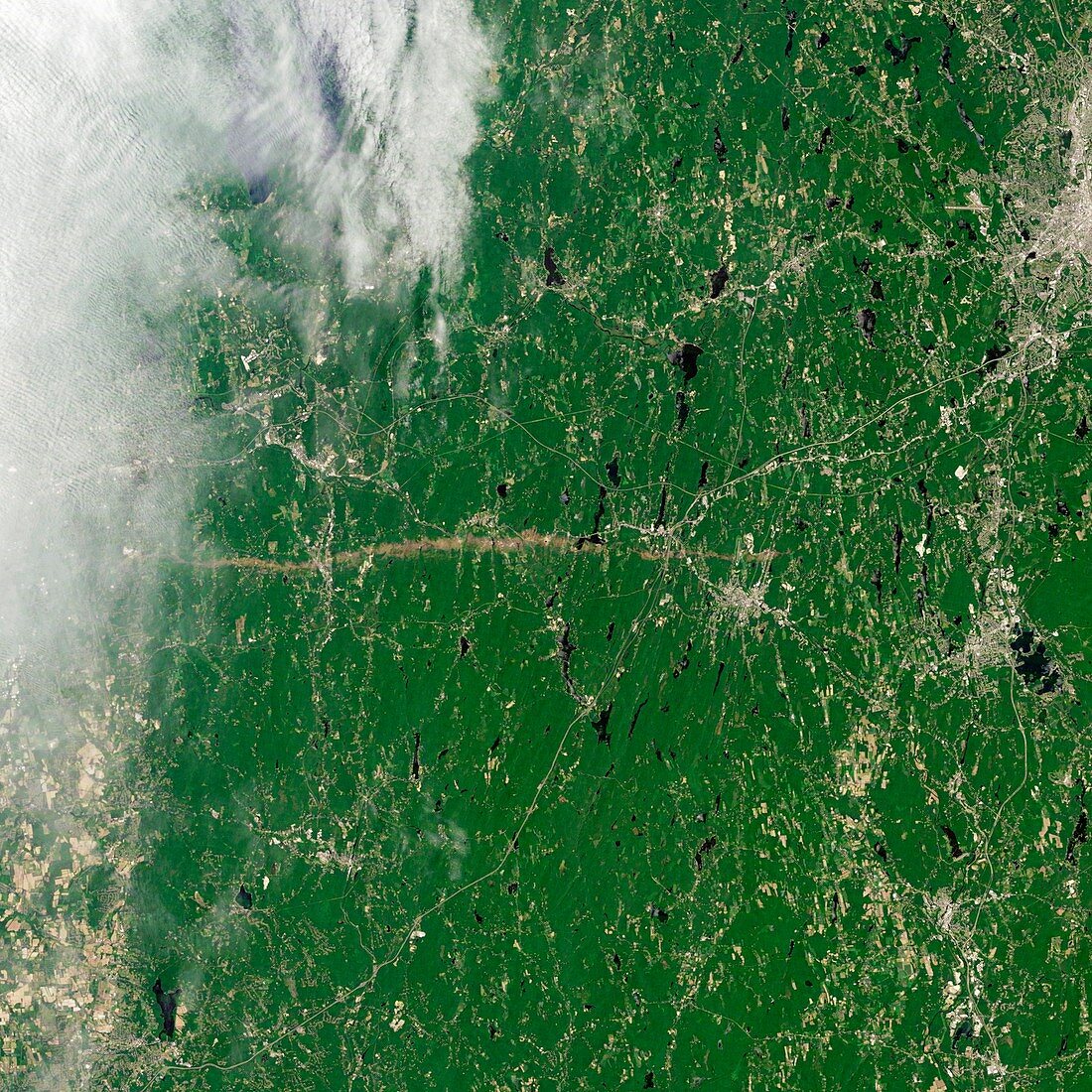
| Tornado track,satellite image. Landsat 5 satellite image showing a tornado track (running middle far left to centre right). On the 1st June 2011,a supercell thunderstorm developed over western Massachusetts. The storm produced an EF3 tornado (severe on the Enhanced Fujita Scale) that cut a 39-mile (63-kilometer) track of destruction across southwest and south-central Massachusetts. The towns of Sturbridge and Soutbridge are right of centre middle and Worcester is upper right. Further east lies the major city of Boston | |
| Lizenzart: | Lizenzpflichtig |
| Credit: | Science Photo Library / NASA |
| Bildgröße: | 2976 px × 2976 px |
| Modell-Rechte: | nicht erforderlich |
| Eigentums-Rechte: | nicht erforderlich |
| Restrictions: | - |
Preise für dieses Bild ab 15 €
Universitäten & Organisationen
(Informationsmaterial Digital, Informationsmaterial Print, Lehrmaterial Digital etc.)
ab 15 €
Redaktionell
(Bücher, Bücher: Sach- und Fachliteratur, Digitale Medien (redaktionell) etc.)
ab 30 €
Werbung
(Anzeigen, Aussenwerbung, Digitale Medien, Fernsehwerbung, Karten, Werbemittel, Zeitschriften etc.)
ab 55 €
Handelsprodukte
(bedruckte Textilie, Kalender, Postkarte, Grußkarte, Verpackung etc.)
ab 75 €
Pauschalpreise
Rechtepakete für die unbeschränkte Bildnutzung in Print oder Online
ab 495 €