Map of Peking Province,16th century
Bildnummer 11613975
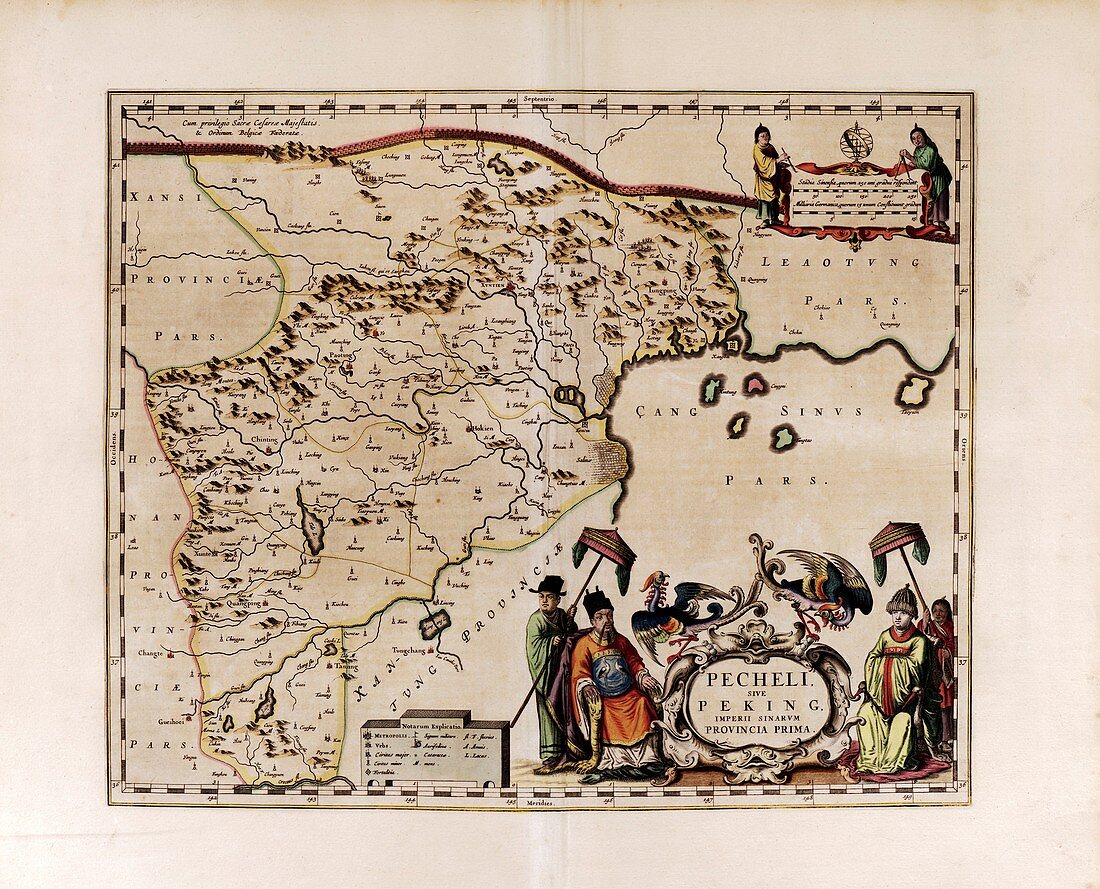
| Map of Peking Province. This 17th-century map shows Peking,the leading province of Imperial China (Ming Dynasty). China's capital city (today called Beijing) is here named Xuntien,an ancient name for Peking,and is at upper centre. Across top is the Great Wall of China. There is a scale at upper right,and a key at bottom giving settlement sizes and symbols for other landmarks. The title artwork (lower right) shows Chinese rulers. This map was produced by the Italian Jesuit missionary and cartographer Martino Martini (1614-1661). It formed part of the atlas 'Novus atlas Sinensis' (Joan Blaeu,Amsterdam,1655). The text is in Latin | |
| Lizenzart: | Lizenzpflichtig |
| Credit: | Science Photo Library / Library of Congress |
| Bildgröße: | 5091 px × 4114 px |
| Modell-Rechte: | nicht erforderlich |
| Eigentums-Rechte: | nicht erforderlich |
| Restrictions: | - |
Preise für dieses Bild ab 15 €
Universitäten & Organisationen
(Informationsmaterial Digital, Informationsmaterial Print, Lehrmaterial Digital etc.)
ab 15 €
Redaktionell
(Bücher, Bücher: Sach- und Fachliteratur, Digitale Medien (redaktionell) etc.)
ab 30 €
Werbung
(Anzeigen, Aussenwerbung, Digitale Medien, Fernsehwerbung, Karten, Werbemittel, Zeitschriften etc.)
ab 55 €
Handelsprodukte
(bedruckte Textilie, Kalender, Postkarte, Grußkarte, Verpackung etc.)
ab 75 €
Pauschalpreise
Rechtepakete für die unbeschränkte Bildnutzung in Print oder Online
ab 495 €
Keywords
- 1600er Jahre,
- 17. Jahrhundert,
- Asiatisch,
- China,
- Chinesisch,
- Chinesische Mauer,
- Erwachsene,
- europäisch,
- geografisch,
- Geographie,
- Geschichte,
- Herrscher,
- historisch,
- Illustration,
- Joan Blaeu,
- Kaiser,
- Karte,
- Kartographie,
- Kunstwerk,
- Latein,
- Lineale,
- Mann,
- Männer,
- Männlich,
- Maßstab,
- Mensch,
- Menschen,
- Ming-Dynastie,
- Niederländisch,
- orientalisch,
- Peking,
- Person,
- Provinz,
- Region,
- Schlüssel