Map of China,17th century
Bildnummer 11613974
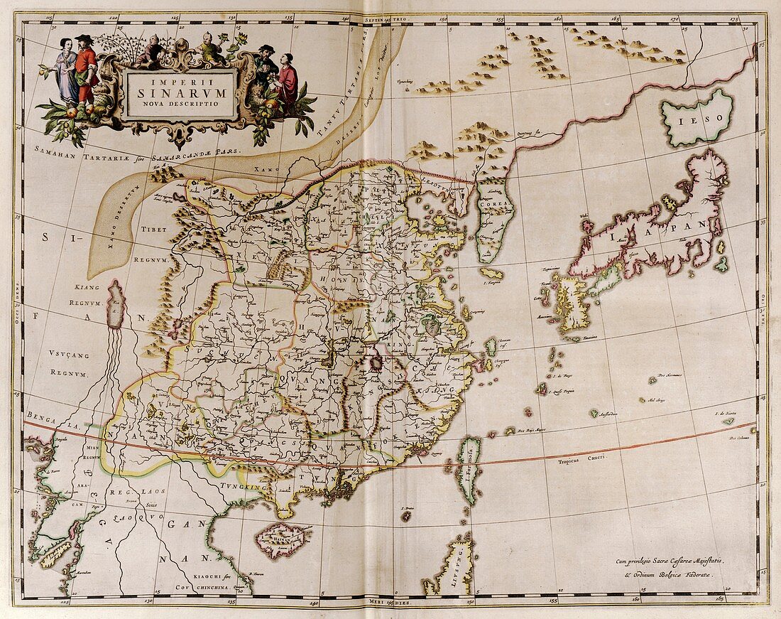
| Map of China. This map shows the sixteen provinces of Imperial China in the 17th century during the Ming Dynasty. Ming territory included vassal states in Korea and Japan (both at upper right). Mountains and towns are shown pictorially and symbolically. Regions shown here include the islands of Hainan (lower left) and Formosa (bisected by the Tropic of Cancer). This map was produced by the Italian Jesuit missionary and cartographer Martino Martini (1614-1661). It formed part of the atlas 'Novus atlas Sinensis' (Joan Blaeu,Amsterdam,1655). The text is in Latin,and the title artwork (upper left) shows Chinese farmers | |
| Lizenzart: | Lizenzpflichtig |
| Credit: | Science Photo Library / Library of Congress |
| Bildgröße: | 5752 px × 4553 px |
| Modell-Rechte: | nicht erforderlich |
| Eigentums-Rechte: | nicht erforderlich |
| Restrictions: | - |
Preise für dieses Bild ab 15 €
Universitäten & Organisationen
(Informationsmaterial Digital, Informationsmaterial Print, Lehrmaterial Digital etc.)
ab 15 €
Redaktionell
(Bücher, Bücher: Sach- und Fachliteratur, Digitale Medien (redaktionell) etc.)
ab 30 €
Werbung
(Anzeigen, Aussenwerbung, Digitale Medien, Fernsehwerbung, Karten, Werbemittel, Zeitschriften etc.)
ab 55 €
Handelsprodukte
(bedruckte Textilie, Kalender, Postkarte, Grußkarte, Verpackung etc.)
ab 75 €
Pauschalpreise
Rechtepakete für die unbeschränkte Bildnutzung in Print oder Online
ab 495 €
Keywords
- 1600er Jahre,
- 17. Jahrhundert,
- Asiatisch,
- China,
- Chinesisch,
- Erwachsene,
- europäisch,
- Farmer,
- Feldfrüchte,
- Formosa,
- Frau,
- Frauen,
- geografisch,
- Geographie,
- Geschichte,
- hainan,
- historisch,
- Illustration,
- Japan,
- Joan Blaeu,
- Karte,
- Kartographie,
- Korea,
- Kunstwerk,
- Land,
- Landwirte,
- Latein,
- Mann,
- Männer,
- Männlich,
- Mensch,
- Menschen,
- Ming-Dynastie,
- Niederländisch,
- Obst,
- orientalisch,
- Person,
- Weiblich