Pampar Luxsar lava complex,Andes
Bildnummer 11613828
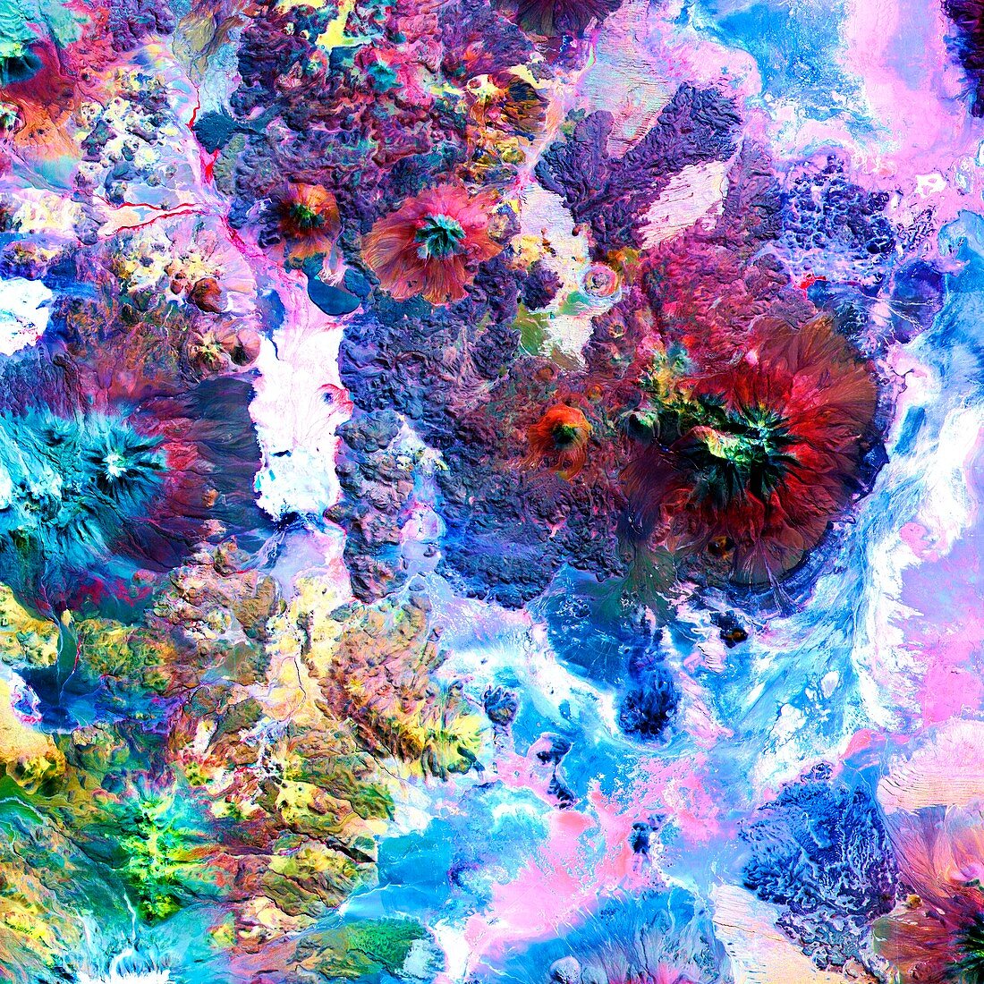
| Pampar Luxsar lava complex,Andes,Chile-Bolivia border,ASTER image from the NASA Terra satellite. The visible and infrared data have been computer enhanced to exaggerate colour differences of the different materials. The Pampa Luxsar lava complex occupies the upper right two-thirds of the scene. Lava flows are distributed around remnants of large dissected cones,the largest of which is Cerro Luxsar. In the middle left edge of the image are the Olca and Parumastrato volcanoes,which appear in blue due to a lack of vegetation (colored red in this composite). This image covers an area 60 kilometers (37 miles) wide and 60 kilometers (37 miles) long. It was acquired on April 7,2000 | |
| Lizenzart: | Lizenzpflichtig |
| Credit: | Science Photo Library / NASA |
| Bildgröße: | 4192 px × 4192 px |
| Modell-Rechte: | nicht erforderlich |
| Eigentums-Rechte: | nicht erforderlich |
| Restrictions: | - |
Preise für dieses Bild ab 15 €
Universitäten & Organisationen
(Informationsmaterial Digital, Informationsmaterial Print, Lehrmaterial Digital etc.)
ab 15 €
Redaktionell
(Bücher, Bücher: Sach- und Fachliteratur, Digitale Medien (redaktionell) etc.)
ab 30 €
Werbung
(Anzeigen, Aussenwerbung, Digitale Medien, Fernsehwerbung, Karten, Werbemittel, Zeitschriften etc.)
ab 55 €
Handelsprodukte
(bedruckte Textilie, Kalender, Postkarte, Grußkarte, Verpackung etc.)
ab 75 €
Pauschalpreise
Rechtepakete für die unbeschränkte Bildnutzung in Print oder Online
ab 495 €