Human presence over Africa at night
Bildnummer 11613340
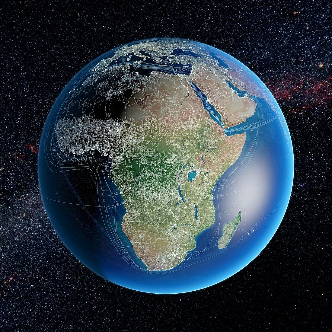
| Human presence over Africa at night. Global map showing major road and rail networks over land,along with transmission line and underwater cable data superimposed over satellite images of cities illuminated at night and land data. Africa is centre middle,southern Europe is at top. This image illustrates modern human impact on the planet | |
| Lizenzart: | Lizenzpflichtig |
| Credit: | Science Photo Library / Pharand-Deschenes, Felix |
| Bildgröße: | 5000 px × 5000 px |
| Modell-Rechte: | nicht erforderlich |
| Eigentums-Rechte: | nicht erforderlich |
| Restrictions: | - |
Preise für dieses Bild ab 15 €
Universitäten & Organisationen
(Informationsmaterial Digital, Informationsmaterial Print, Lehrmaterial Digital etc.)
ab 15 €
Redaktionell
(Bücher, Bücher: Sach- und Fachliteratur, Digitale Medien (redaktionell) etc.)
ab 30 €
Werbung
(Anzeigen, Aussenwerbung, Digitale Medien, Fernsehwerbung, Karten, Werbemittel, Zeitschriften etc.)
ab 55 €
Handelsprodukte
(bedruckte Textilie, Kalender, Postkarte, Grußkarte, Verpackung etc.)
ab 75 €
Pauschalpreise
Rechtepakete für die unbeschränkte Bildnutzung in Print oder Online
ab 495 €
Keywords
- 21. Jahrhundert,
- Afrika,
- Afrikanisch,
- Anthropozän,
- Erdbeobachtung,
- Erde,
- Eurasien,
- Eurasisch,
- Europa,
- europäisch,
- geografisch,
- Geographie,
- Illustration,
- Kabel,
- Kunstwerk,
- Licht,
- menschliche Präsenz,
- modern,
- Modernität,
- Nachtzeit,
- Netzwerk,
- Planet,
- Route,
- Routen,
- Satellit,
- Satellitenbild,
- Schiene,
- Schienen,
- Stadt,
- Stadt in der Nacht,
- Städte,
- Straße,
- Transport,
- Welt in der Nacht