Shipping routes
Bildnummer 11613339
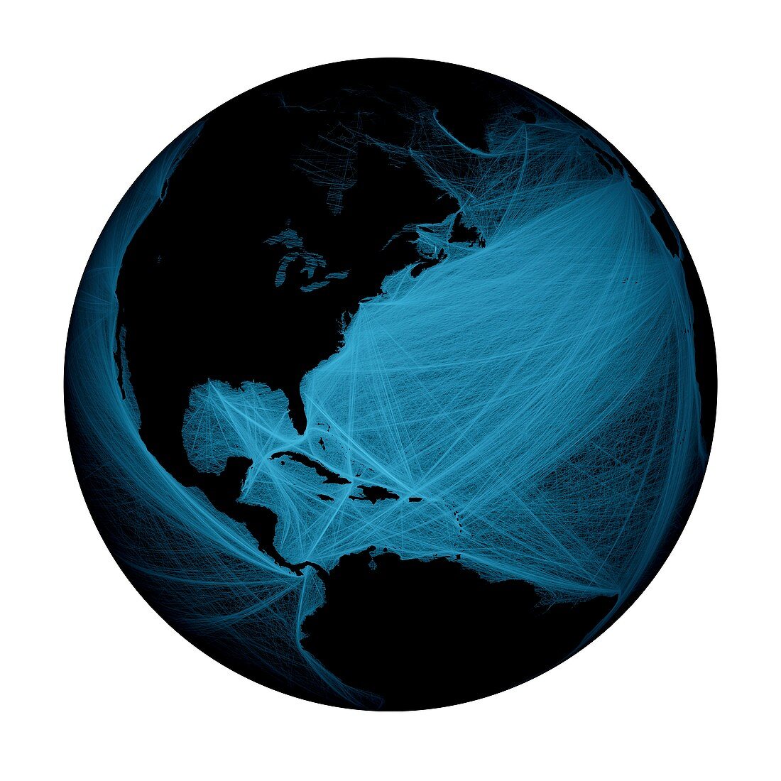
| Shipping routes around North and South America. Global map showing shipping routes superimposed over the Atlantic and Pacific Oceans. Data acquired from NOAA's SEAS BBXX database,from 14.10.2004 to 15.10.2005 | |
| Lizenzart: | Lizenzpflichtig |
| Credit: | Science Photo Library / Pharand-Deschenes, Felix |
| Bildgröße: | 4488 px × 4488 px |
| Modell-Rechte: | nicht erforderlich |
| Eigentums-Rechte: | nicht erforderlich |
| Restrictions: | - |
Preise für dieses Bild ab 15 €
Universitäten & Organisationen
(Informationsmaterial Digital, Informationsmaterial Print, Lehrmaterial Digital etc.)
ab 15 €
Redaktionell
(Bücher, Bücher: Sach- und Fachliteratur, Digitale Medien (redaktionell) etc.)
ab 30 €
Werbung
(Anzeigen, Aussenwerbung, Digitale Medien, Fernsehwerbung, Karten, Werbemittel, Zeitschriften etc.)
ab 55 €
Handelsprodukte
(bedruckte Textilie, Kalender, Postkarte, Grußkarte, Verpackung etc.)
ab 75 €
Pauschalpreise
Rechtepakete für die unbeschränkte Bildnutzung in Print oder Online
ab 495 €
Keywords
- 21. Jahrhundert,
- Amerikanisch,
- Anthropozän,
- Erdbeobachtung,
- Erde,
- geografisch,
- Geographie,
- Illustration,
- Kunstwerk,
- menschliche Präsenz,
- modern,
- Modernität,
- Nordamerika,
- Planet,
- Route,
- Routen,
- Satellit,
- Satellitenbild,
- Schiff,
- Südamerika,
- Transport,
- USA,
- Vereinigte Staaten,
- Versand,
- Welt in der Nacht