Map of marine deposits in Europe
Bildnummer 11611432
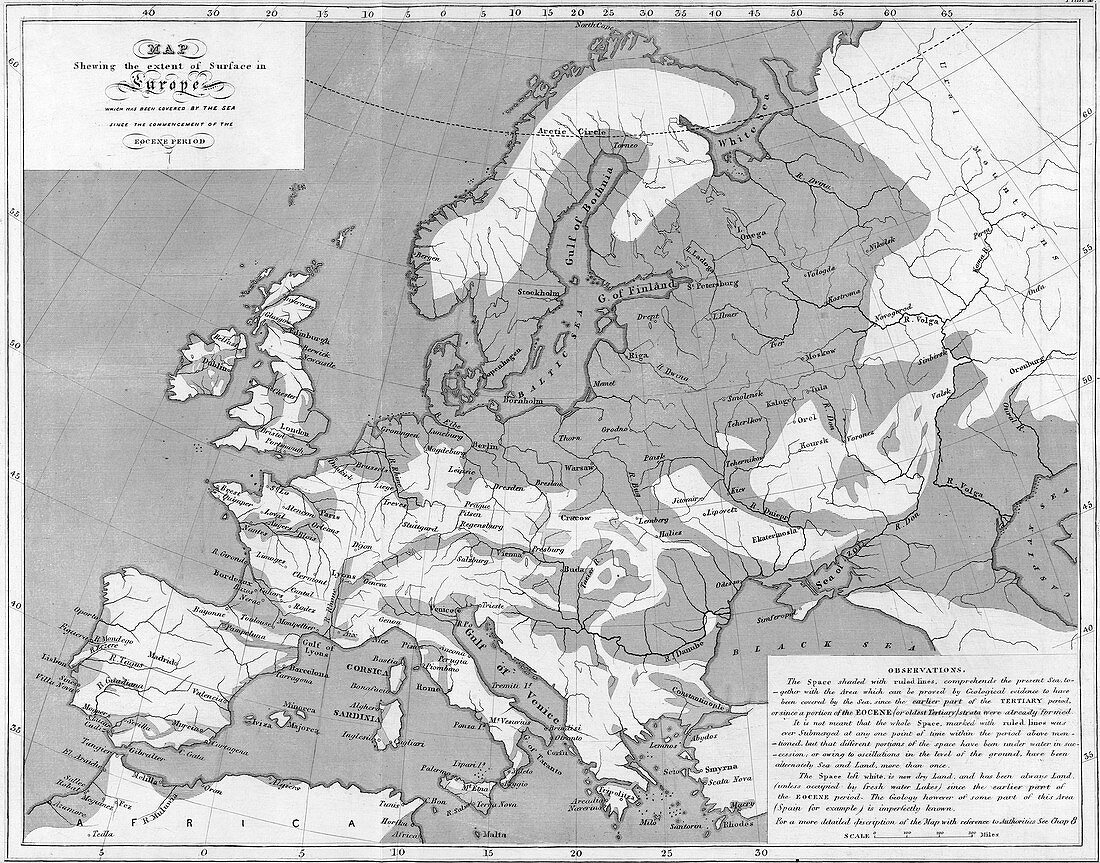
| Marine deposits. Map of Europe showing areas that were under water at some point since the start of the eocene period 56-34 million years ago. The map was derived from observations of outcrops of sedimentary rocks and first appeared in The Principles of Geology by Charles Lyell. This image was taken from the sixth edition of 1853 | |
| Lizenzart: | Lizenzpflichtig |
| Credit: | Science Photo Library / Royal Institution of Great Britain |
| Bildgröße: | 4817 px × 3780 px |
| Modell-Rechte: | nicht erforderlich |
| Restrictions: | - |
Preise für dieses Bild ab 15 €
Universitäten & Organisationen
(Informationsmaterial Digital, Informationsmaterial Print, Lehrmaterial Digital etc.)
ab 15 €
Redaktionell
(Bücher, Bücher: Sach- und Fachliteratur, Digitale Medien (redaktionell) etc.)
ab 30 €
Werbung
(Anzeigen, Aussenwerbung, Digitale Medien, Fernsehwerbung, Karten, Werbemittel, Zeitschriften etc.)
ab 55 €
Handelsprodukte
(bedruckte Textilie, Kalender, Postkarte, Grußkarte, Verpackung etc.)
ab 75 €
Pauschalpreise
Rechtepakete für die unbeschränkte Bildnutzung in Print oder Online
ab 495 €