West Berlin Air Corridor
Bildnummer 11608413
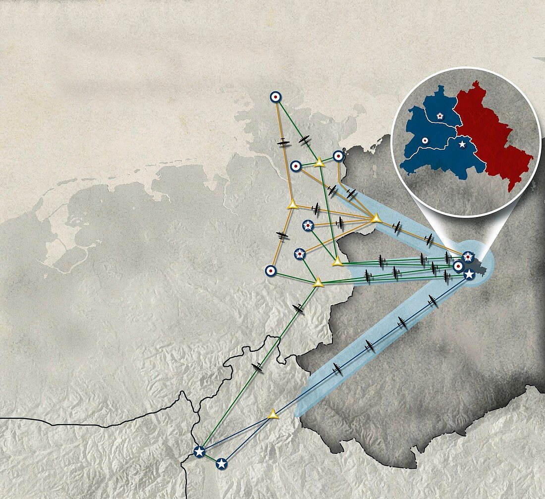
| West Berlin Air Corridor. Map showing the corridors controlling control air traffic to and from West Berlin following the division of Germany and its capital city in 1949 after the Second World War. Berlin was in East Germany (grey on main map). In the inset (upper right),East Berlin (red) was controlled by the Soviet Union,and West Berlin (blue) by (north to south) France,the UK,and the USA. The symbols show which countries flew to which cities in West Germany. These cities included Hamburg and Bremen (northern corridor),Hanover,Dusseldorf and Bonn (central corridors),and Frankfurt and Stuttgart (southern corridor) | |
| Lizenzart: | Lizenzpflichtig |
| Credit: | Science Photo Library / Lunau, Claus |
| Bildgröße: | 4375 px × 4004 px |
| Modell-Rechte: | nicht erforderlich |
| Eigentums-Rechte: | nicht erforderlich |
| Restrictions: | - |
Preise für dieses Bild ab 15 €
Universitäten & Organisationen
(Informationsmaterial Digital, Informationsmaterial Print, Lehrmaterial Digital etc.)
ab 15 €
Redaktionell
(Bücher, Bücher: Sach- und Fachliteratur, Digitale Medien (redaktionell) etc.)
ab 30 €
Werbung
(Anzeigen, Aussenwerbung, Digitale Medien, Fernsehwerbung, Karten, Werbemittel, Zeitschriften etc.)
ab 55 €
Handelsprodukte
(bedruckte Textilie, Kalender, Postkarte, Grußkarte, Verpackung etc.)
ab 75 €
Pauschalpreise
Rechtepakete für die unbeschränkte Bildnutzung in Print oder Online
ab 495 €
Keywords
- 1900er Jahre,
- 20. Jahrhundert,
- Amerikanisch,
- Base,
- basen,
- Berlin,
- Bremen,
- britisch,
- Deutschland,
- Diagramm,
- Düsseldorf,
- Europa,
- europäisch,
- Frankfurt,
- Frankreich,
- Französisch,
- Geschichte,
- Großbritannien,
- Hamburg,
- Hannover,
- historisch,
- Illustration,
- Kalter Krieg,
- Karte,
- Kriegsführung,
- Kunstwerk,
- Militär-,
- Politik,
- Sovietunion,
- Stadt,
- Städte,
- Stuttgart,
- USA,
- Vereinigte Staaten,
- Vereinigtes Königreich,
- ww2,
- wwii,
- Zweiter Weltkrieg