Stonehenge,18th Century plan
Bildnummer 11602161
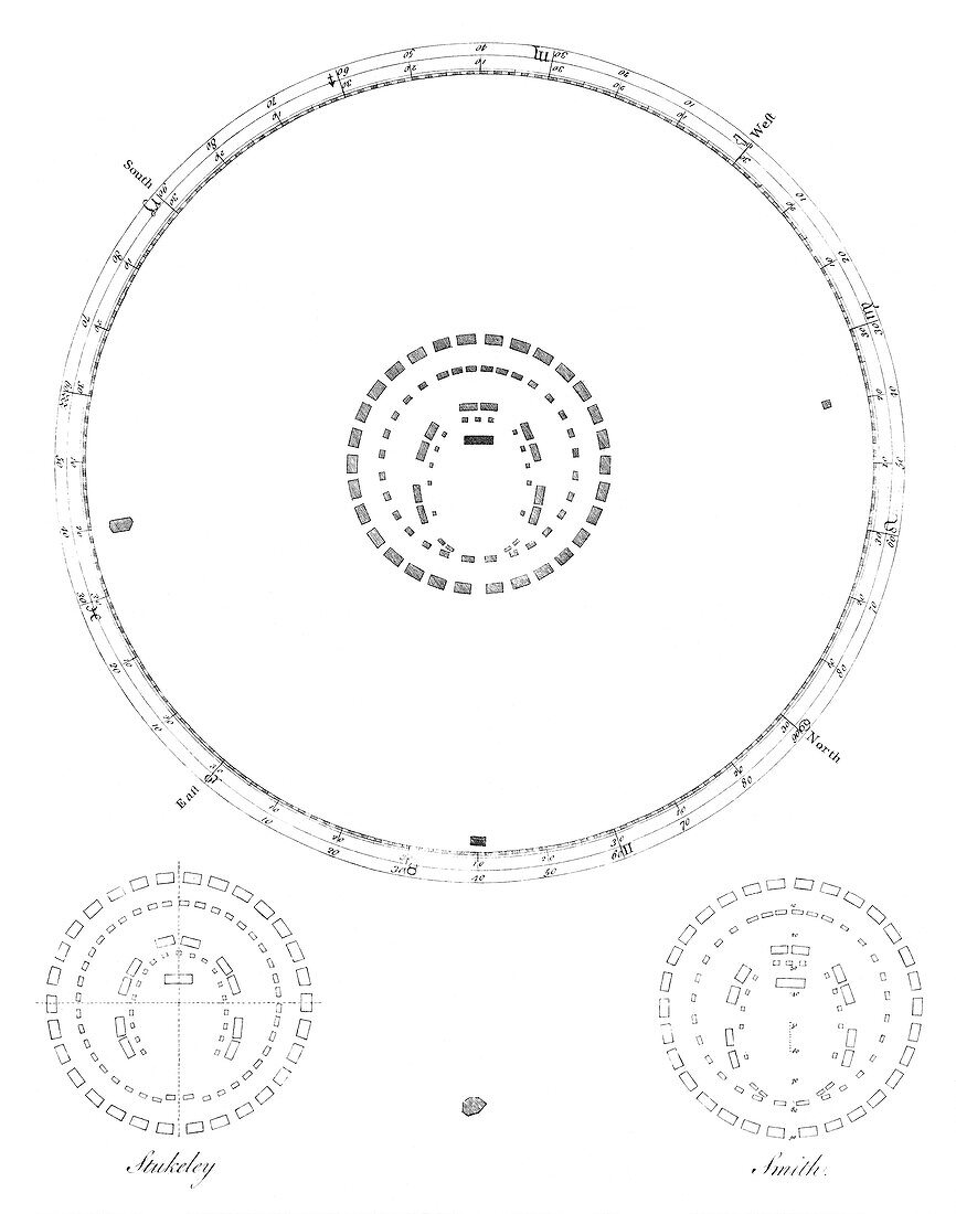
| Stonehenge. 18th Century plan of Stonehenge by John Smith,showing the position of the stones (centre) and their alignment with the points of the compass (outer ring). The bottom two diagrams show Smith's plan (right) compared to that of William Stukeley (1687-1765,left). Image published in Smith's paper 'Choir Gaur; The Grand Orrery of the Ancient Druids,Commonly Called Stonehenge,Astronomically Explained,and Mathematically Proved to Be a Temple' (1771) | |
| Lizenzart: | Lizenzpflichtig |
| Credit: | Science Photo Library / Royal Astronomical Society |
| Bildgröße: | 3756 px × 4772 px |
| Modell-Rechte: | nicht erforderlich |
| Eigentums-Rechte: | nicht erforderlich |
| Restrictions: | - |
Preise für dieses Bild ab 15 €
Universitäten & Organisationen
(Informationsmaterial Digital, Informationsmaterial Print, Lehrmaterial Digital etc.)
ab 15 €
Redaktionell
(Bücher, Bücher: Sach- und Fachliteratur, Digitale Medien (redaktionell) etc.)
ab 30 €
Werbung
(Anzeigen, Aussenwerbung, Digitale Medien, Fernsehwerbung, Karten, Werbemittel, Zeitschriften etc.)
ab 55 €
Handelsprodukte
(bedruckte Textilie, Kalender, Postkarte, Grußkarte, Verpackung etc.)
ab 75 €
Pauschalpreise
Rechtepakete für die unbeschränkte Bildnutzung in Print oder Online
ab 495 €
Keywords
- 18. Jahrhundert,
- Archäologie,
- archäologisch,
- Astronomie,
- astronomisch,
- ausgeschnitten,
- Ausschnitte,
- britisch,
- Diagramm,
- Einfarbig,
- England,
- Englisch,
- Europa,
- europäisch,
- Geschichte,
- Großbritannien,
- henge,
- historisch,
- Illustration,
- Kunstwerk,
- Layout,
- Mathematik,
- mathematisch,
- Megalith,
- Megalithen,
- neolithisch,
- Orientierung,
- Pläne,
- Planen,
- Position,
- Positionen,
- Schwarz und weiß,
- Stein,
- Steine,
- Vereinigtes Königreich,
- vergleichen,
- verglichen,
- Veröffentlichung,
- weißer Hintergrund