Natori,Japan,satellite image
Bildnummer 11600104
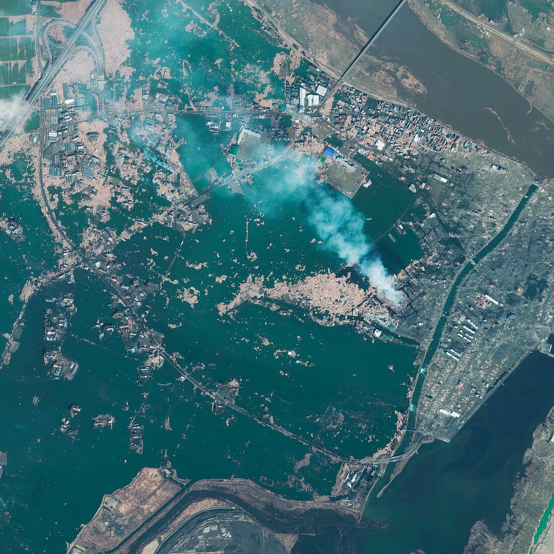
| Natori. Satellite image of the town of Natori,Miyagi prefecture,Japan,taken one day after the 2011 earthquake and tsunami. The magnitude 9.0 earthquake struck 130km off the east coast of Japan at 14.46 local time (05.46 GMT) on 11th March 2011,triggering an enormous Tsunami. It was the largest earthquake ever recorded in Japan and the 5th largest in the world. Tidal waves of up to 10 metres high swept ashore,devastating areas up to 10km inland and 'wiping Natori off the map'. Imaged by GeoEye's IKONOS satellite at 10.36am local time,on 12th March 2011 from 680km in space | |
| Lizenzart: | Lizenzpflichtig |
| Credit: | Science Photo Library / Digital Globe |
| Bildgröße: | 3000 px × 3000 px |
| Modell-Rechte: | nicht erforderlich |
| Eigentums-Rechte: | nicht erforderlich |
| Restrictions: | - |
Preise für dieses Bild ab 15 €
Universitäten & Organisationen
(Informationsmaterial Digital, Informationsmaterial Print, Lehrmaterial Digital etc.)
ab 15 €
Redaktionell
(Bücher, Bücher: Sach- und Fachliteratur, Digitale Medien (redaktionell) etc.)
ab 30 €
Werbung
(Anzeigen, Aussenwerbung, Digitale Medien, Fernsehwerbung, Karten, Werbemittel, Zeitschriften etc.)
ab 55 €
Handelsprodukte
(bedruckte Textilie, Kalender, Postkarte, Grußkarte, Verpackung etc.)
ab 75 €
Pauschalpreise
Rechtepakete für die unbeschränkte Bildnutzung in Print oder Online
ab 495 €
Keywords
- 2011,
- 21. Jahrhundert,
- Asiatisch,
- Asien,
- Ausrüstung,
- Beschädigt,
- Dorf,
- Erdbeben,
- Erdbeobachtung,
- extrem,
- Feuer,
- Flut,
- Flut-,
- Gebäude,
- geografisch,
- Geographie,
- Geschichte,
- größte,
- Haus,
- Häuser,
- historisch,
- IKONOS,
- Japan,
- Japanisch,
- Küste,
- Küsten-,
- miyagi,
- Naturkatastrophe,
- Rauch,
- Rauchen,
- Satellit,
- Satellitenbild,
- Schaden,
- Sommer,
- Stadt,
- städtisch,
- technologisch,
- tohoku,
- Tsunami,
- überflutet,
- Umwelt,
- Umweltwissenschaften,
- Unfall,
- Verwüstung,
- Von Oben,
- Wasser,
- Welle,
- Wohnhäuser,
- Zerstörung,
- Zuhause