Rainfall levels,November 2004
Bildnummer 11599571
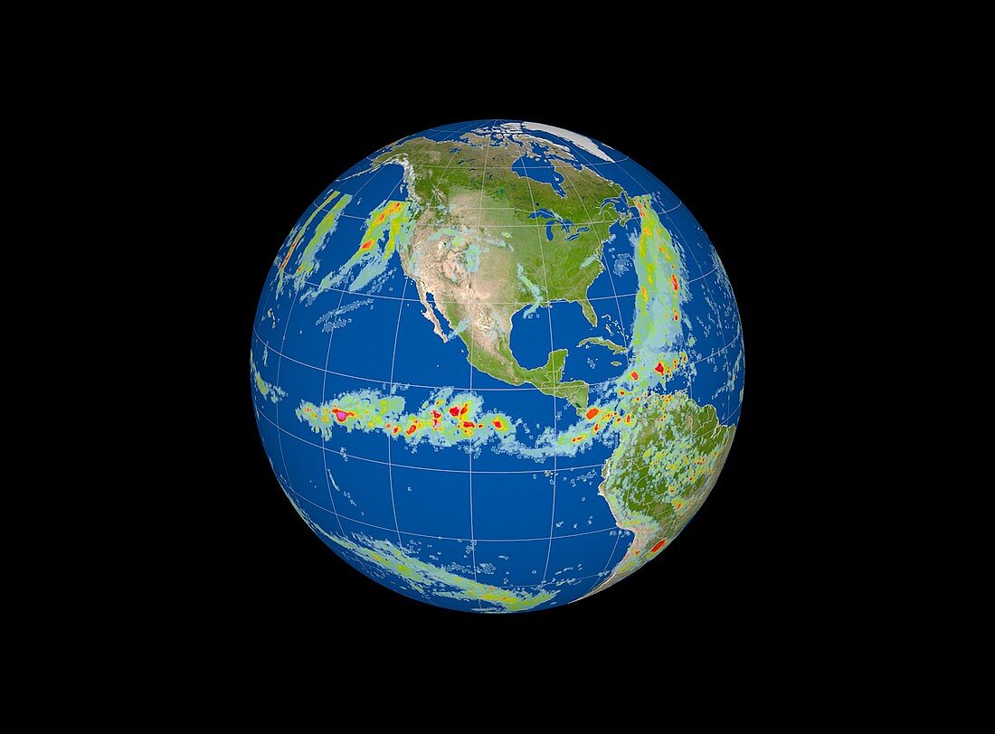
| Rainfall levels. Satellite image showing precipitation levels over the Americas and parts of the Atlantic (upper right) and Pacific Oceans (left) on 8th November 2004. Amount of precipitation,measured in millimetres,is colour-coded from green (lowest) through yellow,orange and red to purple (highest). Rain across the middle of the Pacific Ocean,as seen here,is typical of an El nino year. El Nino is a warming of surface waters in the tropical eastern Pacific Ocean. It may persist for a year or more,and causes drier conditions in Australia and South-East Asia,and wetter and warmer conditions in the Americas,with often dire effects for agriculture. Data from NASA's Global Precipitation Measurement (GPM) mission | |
| Lizenzart: | Lizenzpflichtig |
| Credit: | Science Photo Library / NASA's Goddard Space Flight Center / SVS |
| Bildgröße: | 3441 px × 2539 px |
| Modell-Rechte: | nicht erforderlich |
| Eigentums-Rechte: | nicht erforderlich |
| Restrictions: | - |
Preise für dieses Bild ab 15 €
Universitäten & Organisationen
(Informationsmaterial Digital, Informationsmaterial Print, Lehrmaterial Digital etc.)
ab 15 €
Redaktionell
(Bücher, Bücher: Sach- und Fachliteratur, Digitale Medien (redaktionell) etc.)
ab 30 €
Werbung
(Anzeigen, Aussenwerbung, Digitale Medien, Fernsehwerbung, Karten, Werbemittel, Zeitschriften etc.)
ab 55 €
Handelsprodukte
(bedruckte Textilie, Kalender, Postkarte, Grußkarte, Verpackung etc.)
ab 75 €
Pauschalpreise
Rechtepakete für die unbeschränkte Bildnutzung in Print oder Online
ab 495 €