Antarctic ozone hole,2000
Bildnummer 11599567
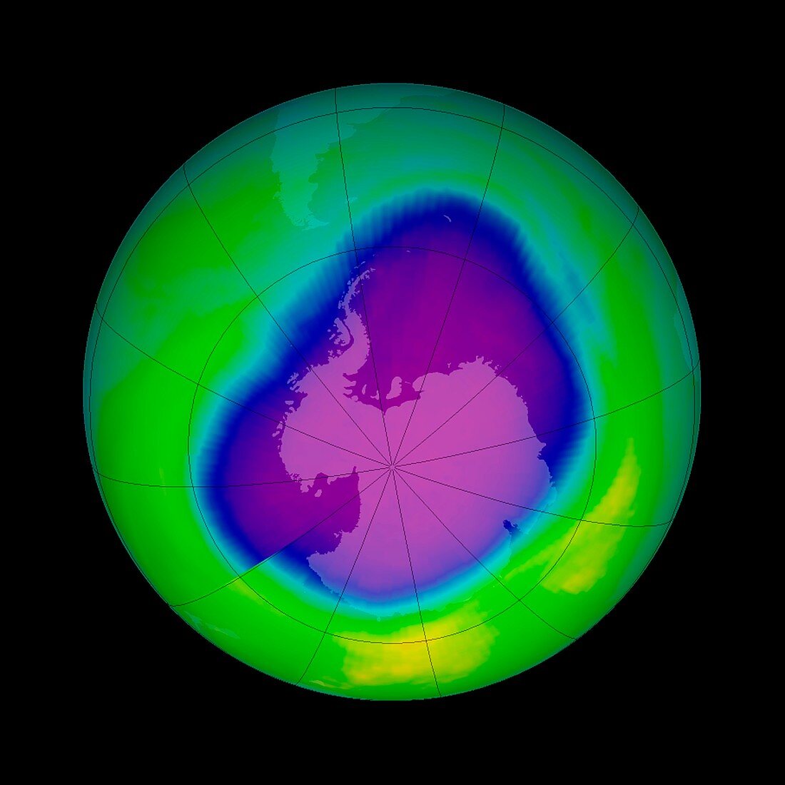
| Antarctic ozone hole. Satellite image of the ozone hole (purple) over Antarctica (centre) on 29th September 2000. Ozone layer thicknesses are colour coded from purple (lowest) through blue,cyan and green to yellow (highest). This was the broadest ever hole,stretching over 29.9 million square kilometres. Chlorofluorocarbons (CFCs),which were responsible for much of the ozone depletion were phased out from the late 1980s to the mid 1990s,but the damage to the ozone didn't peak until 2006. Data from the Total Ozone Mapping Spectrometer (TOMS) | |
| Lizenzart: | Lizenzpflichtig |
| Credit: | Science Photo Library / NASA |
| Bildgröße: | 2965 px × 2965 px |
| Modell-Rechte: | nicht erforderlich |
| Eigentums-Rechte: | nicht erforderlich |
| Restrictions: | - |
Preise für dieses Bild ab 15 €
Universitäten & Organisationen
(Informationsmaterial Digital, Informationsmaterial Print, Lehrmaterial Digital etc.)
ab 15 €
Redaktionell
(Bücher, Bücher: Sach- und Fachliteratur, Digitale Medien (redaktionell) etc.)
ab 30 €
Werbung
(Anzeigen, Aussenwerbung, Digitale Medien, Fernsehwerbung, Karten, Werbemittel, Zeitschriften etc.)
ab 55 €
Handelsprodukte
(bedruckte Textilie, Kalender, Postkarte, Grußkarte, Verpackung etc.)
ab 75 €
Pauschalpreise
Rechtepakete für die unbeschränkte Bildnutzung in Print oder Online
ab 495 €
Keywords
- 21. Jahrhundert,
- Antarktis,
- Atmosphäre,
- ausgeschnitten,
- Ausschnitte,
- Beschädigt,
- chemisch,
- Erdbeobachtung,
- Erde,
- Forschung,
- Geowissenschaften,
- Globus,
- Kreis,
- kreisförmig,
- Kugel,
- kugelförmig,
- Messung,
- Montreal-Protokoll,
- NASA,
- Planet,
- Planetenwissenschaft,
- polar,
- rund,
- Satellit,
- Satellitenbild,
- Schaden,
- Spektrometer,
- Süd-,
- südlichen Hemisphäre,
- Umwelt,
- Umweltwissenschaften,
- verschmutzt,
- Verschmutzung,
- Weltall