British Isles,satellite image
Bildnummer 11599179
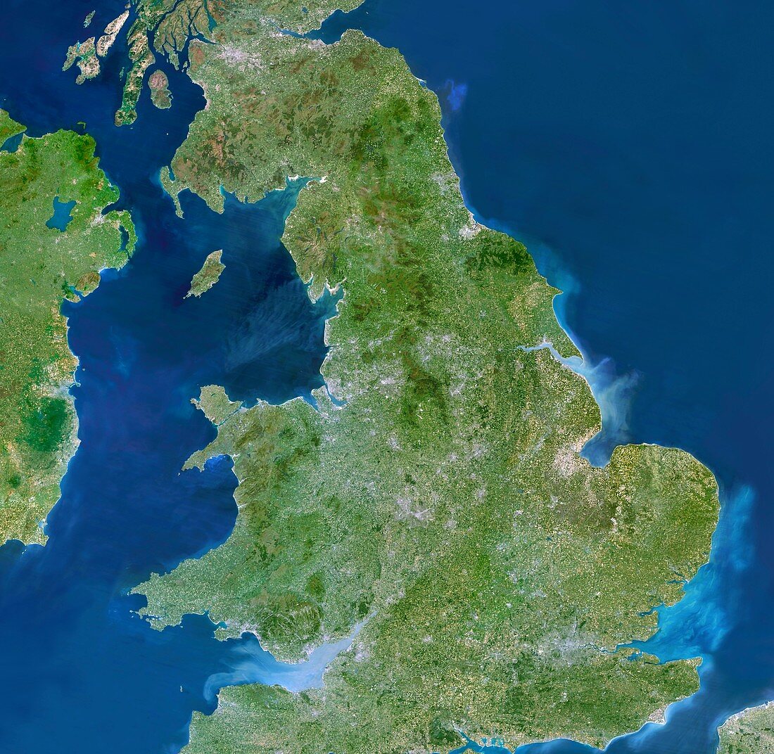
| British Isles,satellite image. North is at top. Most of the British mainland is shown here. Northern Ireland is at upper left,with parts of the Republic of Ireland and France also seen | |
| Lizenzart: | Lizenzpflichtig |
| Credit: | Science Photo Library / Planetobserver |
| Bildgröße: | 6007 px × 5854 px |
| Modell-Rechte: | nicht erforderlich |
| Eigentums-Rechte: | nicht erforderlich |
| Restrictions: | - |
Preise für dieses Bild ab 15 €
Universitäten & Organisationen
(Informationsmaterial Digital, Informationsmaterial Print, Lehrmaterial Digital etc.)
ab 15 €
Redaktionell
(Bücher, Bücher: Sach- und Fachliteratur, Digitale Medien (redaktionell) etc.)
ab 30 €
Werbung
(Anzeigen, Aussenwerbung, Digitale Medien, Fernsehwerbung, Karten, Werbemittel, Zeitschriften etc.)
ab 55 €
Handelsprodukte
(bedruckte Textilie, Kalender, Postkarte, Grußkarte, Verpackung etc.)
ab 75 €
Pauschalpreise
Rechtepakete für die unbeschränkte Bildnutzung in Print oder Online
ab 495 €
Keywords
- Britische Inseln,
- England,
- Erdbeobachtung,
- Europa,
- europäisch,
- geografisch,
- Geographie,
- Großbritannien,
- Insel,
- Inseln,
- Irisch,
- Irische See,
- Irland,
- Küste,
- Küsten,
- Küsten-,
- Küstenlinie,
- Land,
- Meer,
- Nation,
- Nordirland,
- Nordsee,
- Satellit,
- Satellitenbild,
- schottisch,
- Schottland,
- Vereinigtes Königreich,
- Wales,
- Walisisch,
- Weltall